|
May 6, 2023
|
W. Rosamond Blvd (Cutoff) to Hwy 138 (Hikertown USA)
|
|
Mile 531-517
|
4:45 (moving) / 5:45 (total)
|
|
|
Max 3,211 feet (+998 / -729)
|


Pacific Crest Trail – Section E Leg 6 (Southbound W. Rosamond Blvd (Cutoff) to Hikertown USA)
What's the old saying, "the third time is a charm?" We've been talking about hiking this section for 2 years. Oobrianoo first suggested this as a perfect "winter" hike to avoid a summer hike thru the desert. It would be about the furthest from I would drive and most certainly the furthest Oobrianoo would drive as he would be coming from the San Diego area. Our first failed road trip north to this section was early 2021, again fall 2022, and then finally the idea had been tossed around once again early 2023. 2023 was the bizarre winter storms that repeatedly hit California so we were still snowed in from continuing where we left off on Section C so it seemed to be the best alternative to try to stretch out our legs and get some more trail miles under our belt.
In April Mai and I were able to get in a short PCT hike that was close to home, but it had been all the way back to October 2022 the last time I hiked with Oobrianoo and all the way back to June 2022 which was the last time all three of us hiked together. Most PCT sections have been solid all day adventures and this one would be no different. Our meeting point would be Hikertown USA, 99 miles from home. Not quite as far away as Lake Morena which was 163 miles.
I think the first time we talked about driving to Hikertown USA we were going to get a room close to the trailhead, however, if Oobrianoo could make it by getting up really early we choose to do the same. Some hikes are really hard, but as long as it wasn't going to be a hot day this one should be a long (17.3 mile) walk in the park. The trail pretty much parallels the California Aqueduct thru a corner of the Mojave Desert so there isn't a lot of vertical feet gained or lost.
For trail logistics we would drive two cars and meet at Hikertown USA. Once there we would try to figure out the best way to get to Cottonwood Bridge for our hike back. We had several options, however, it seemed as private land so leaving a 2nd car at the start point seemed to be less desirable. One option is a guy named Bob that lives at Hikertown, he's older gentleman but his son seems like one option to drop us off. Another option is Uber/Lyft, however when we arrived we tried and while we were able to contact drivers non would drive 15 minutes from where they were to pick us up. Our final option was a market that frequetly picks up hikers, takes them to the market and drive them back. This would be our ride!
Before starting was coming up with a plan when to meet. We figured 17 miles would take about 6 hours plus commute there and back would make for a long day. Mai had changed her work schedule so she would have Saturday off so all three of us could hike together. The plan was to meet at Hikertown at 10 a.m. and see how the day unfolds. We got on the road about the time we had planned but some construction on I-5 north and slow traffic re-routed us on Google maps and took us on a side road which delayed our arrival.
I have an expression I always use that is called "my bubble" which is the area that I usually stay within and anything outside my bubble is generally more than one day adventure. This drive took me outside my bubble to an area north of Los Angeles I've rarely visited so for me it's a big adventure, if you will, outside my comfort zone. It's certainly a beautiful drive up the I-5 and so many future explorations I hope in the near future!
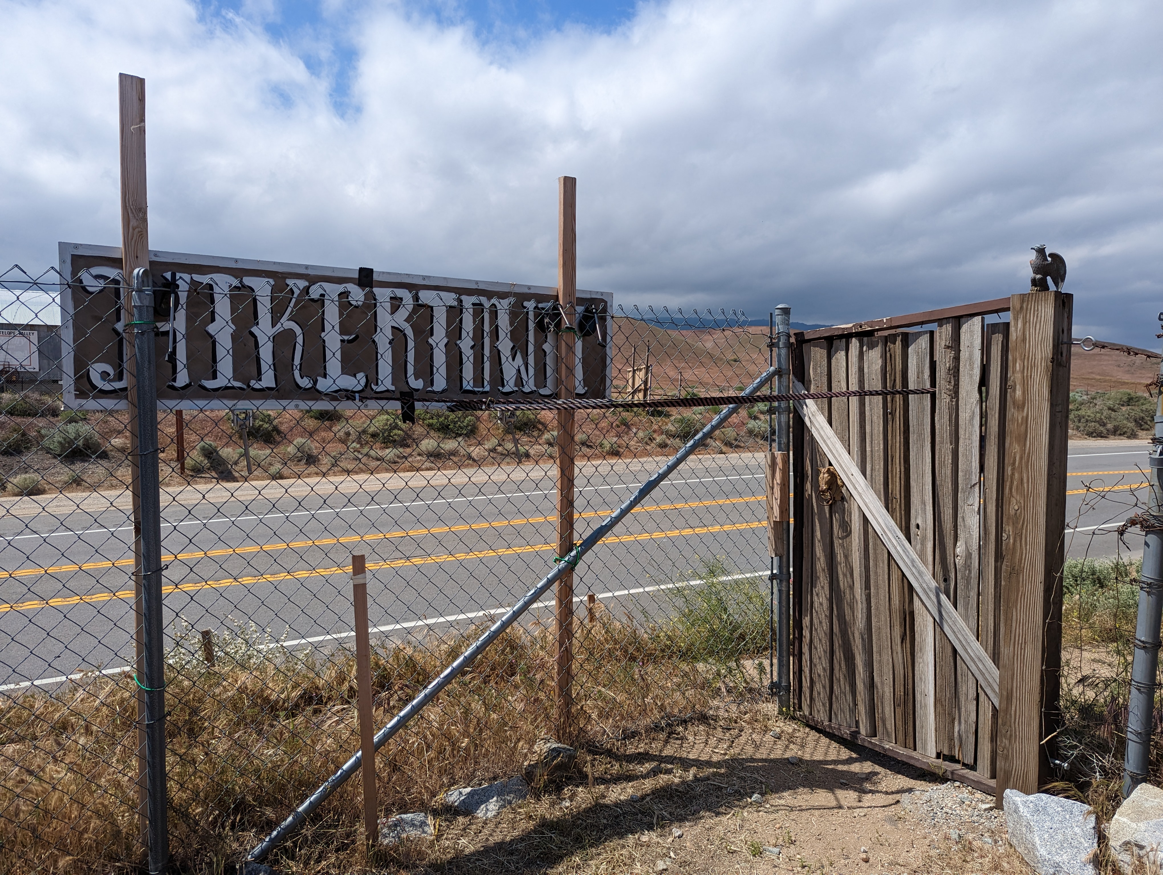
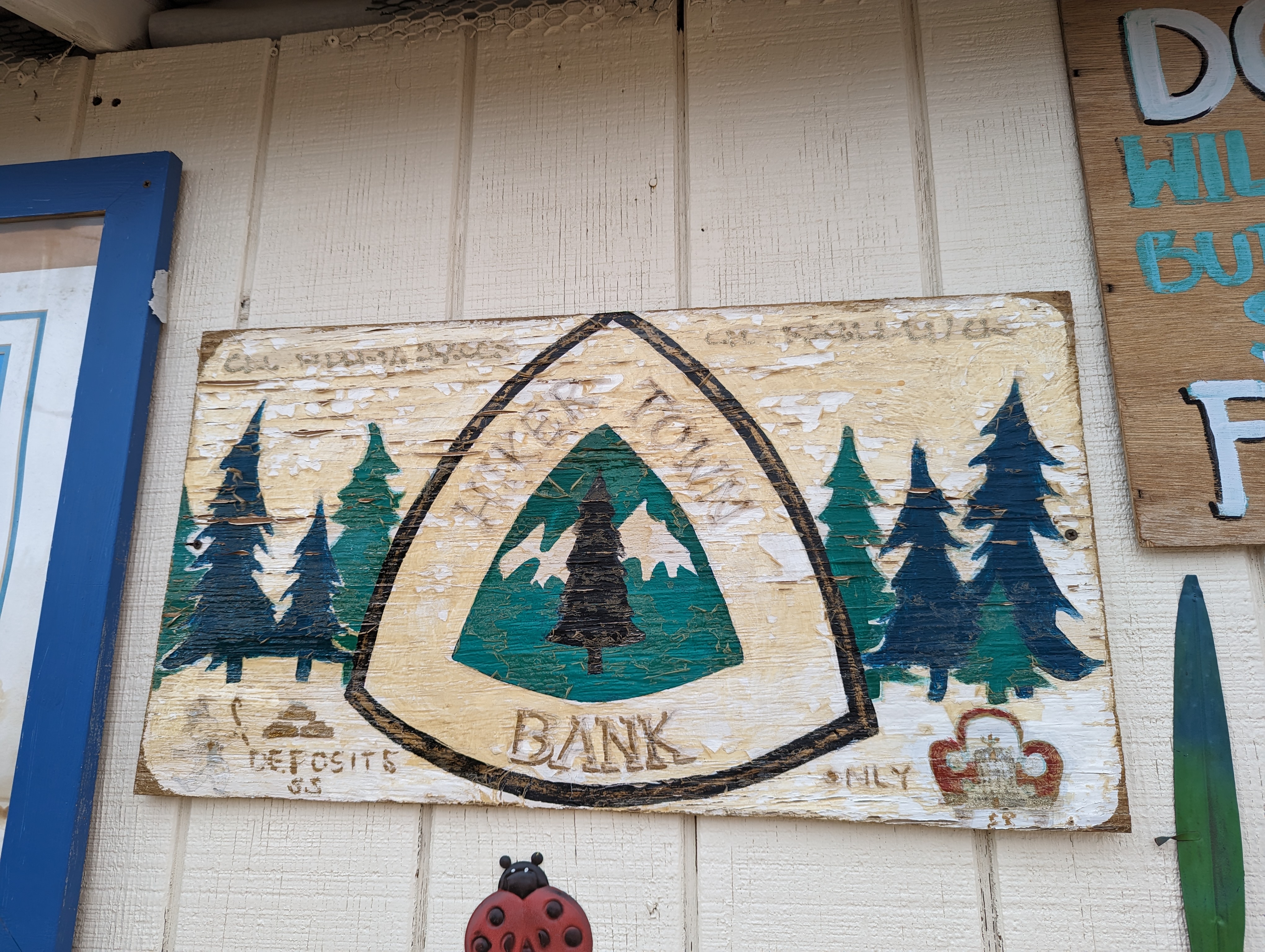
Mai and I finally arrive at Hikertown USA, easily recognizable as you drive by with all the different country's flags along the property that borders State Route 38. We arrived early enough that the gate was still closed and called Oobrianoo who had already entered and he helped direct us thru a 2nd gate in the rear of the property. While eagar to get started at the same time I was eager to explore Hikertown and see what it was all about. It was certainly and interesting place to visit. Many of this years PCT class were in this general vicinity on the PCT so we had hoped to see a few of them. Immediately recognizable were a couple thru hikers on the property. I think most of them, by 10 a.m., were already back on the trail and heading north.
The property seemed stuck back in time and felt like an old western movie. There were buildings across the property which apparently are places to rent, however, the face of them are different building such as "a bank", "the sherriff", etc. I think thru hikers could camp there as well as rent out one of the rooms. While it looked old and run down, there was a cleaning lady going house to house cleaning up.
Our taxi from the market was bringing back a thru hiker from town as we boarded to head north so we could begin our southbound hike back to Hikertown USA. Not having been here before it was all new scenery to take in. As we drove we could see field of solar panels and tons of electric turbine/windmills. Getting out of the car is was a little cold and a little windy. I thought the locals knew the area and where we wanted him to drop us off, however, perhaps just confusion or a language barrier we ended up getting dropped off before we reached our planned stop. We were dropped off at the end of the paved road, but it looked as if the dirt road ahead was well maintained and could have taken us where we had intended to be dropped off but our driver was off so fast we didn't have time to ask him to take us a little farther.
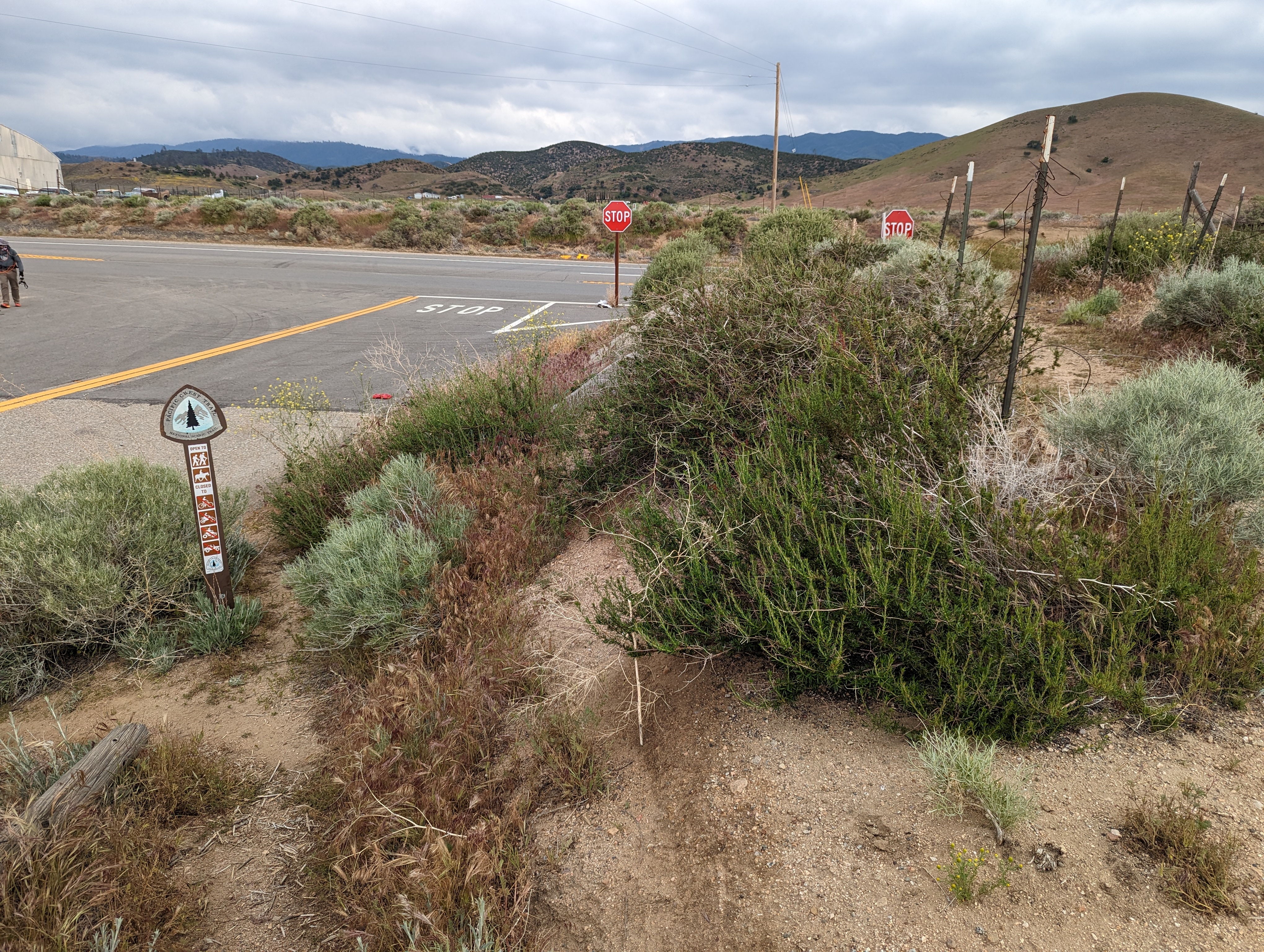
This meant our planned 17.3 mile hike was already going to be a little shorter than originally planned. The good news is because we got such a late start we would get back before dark whereas if we had to hike a few more miles to hike we could have cut it short on daylight. Now standing at an intersection of dirt roads the next question was which way to go. A little common sense knowing where we had to go and we quickly figured out the correct way. Also a quick glance at the FarOut App and it showed we had about 1 miles until we intersected with the PCT.
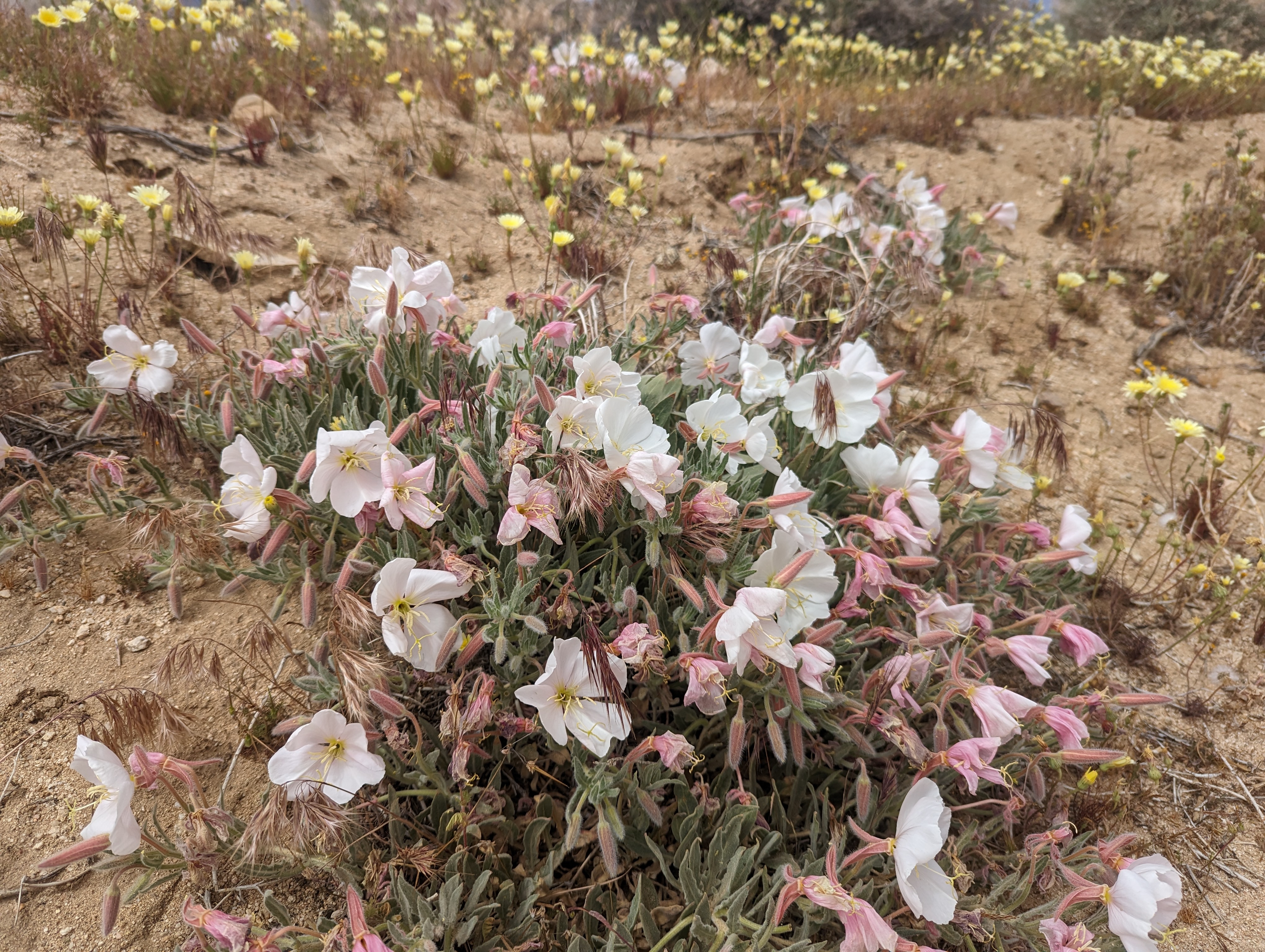
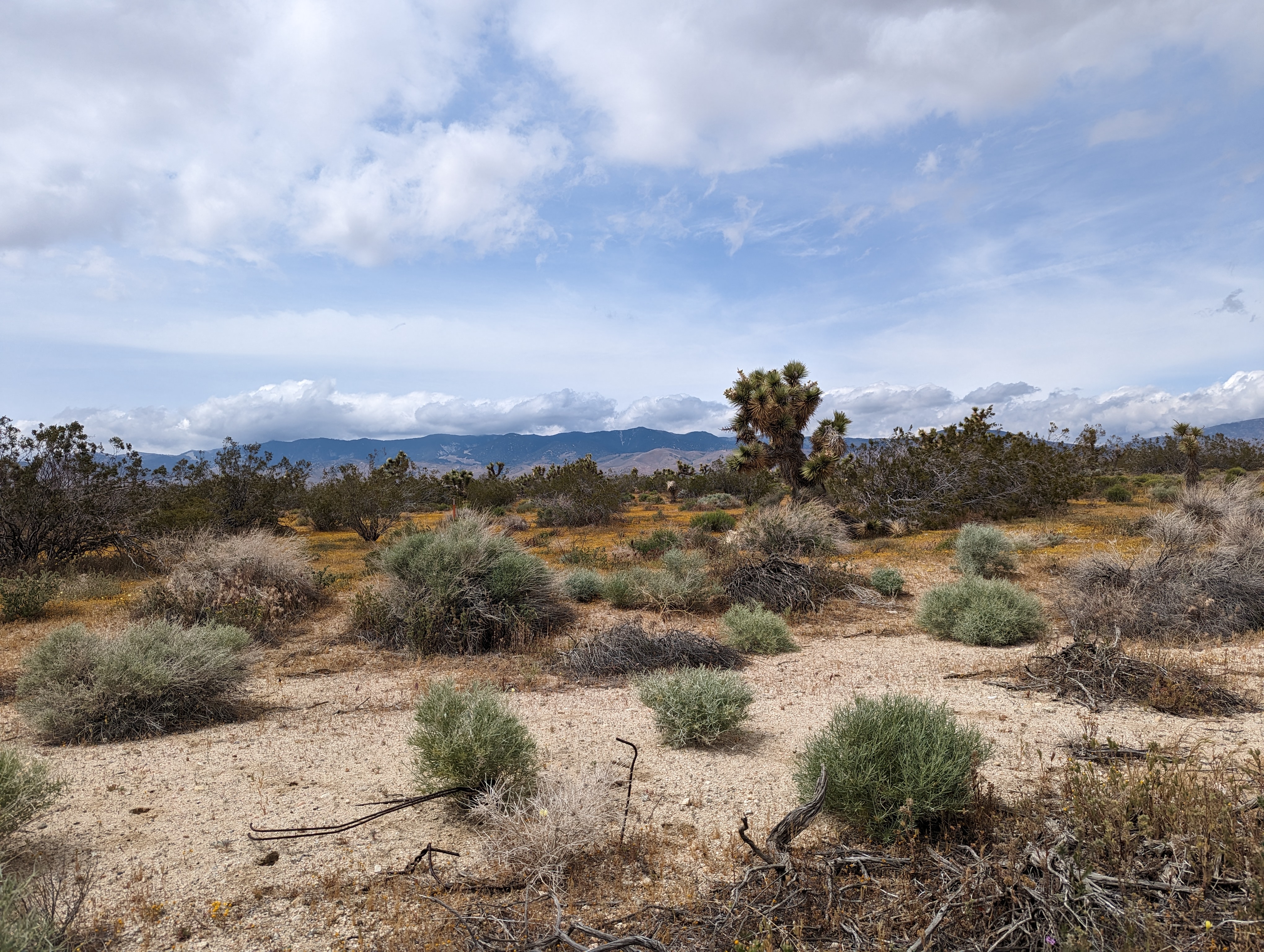
Behind us and further up the hill were giant wind turbines but we really never hiked right next to them. It was spring and we have had a lot of rain so there were lots of flowers in bloom. We were not far from the California Poppy Reserve and could see patches of orange poppies across the valley. As we made our way down the dirty road we ran across a water company pickup coming our way which the driver gave us a friendly wave. Still uncertain if it was save/appropriate to leave a car where we started but by the time he passed us it was too late to ask.
I had seen pictures of the aqueduct in our guide and knew exactly what I was looking for, however, when according to our map when we intersected with the PCT there was no aqueduct in site. I was disappointed because I thought we would be walking next to water the entire hike. We turned left and started southbound towards Hikerstown USA. Already we saw groups of thru hikers coming our way as we were now going in the opposite direction of each of them.
They were just hiking down a wide dirt road, however, I found a single track trail that zigzagged next to the road so decided to follow it for a while as we were more in the middle of the spring floral vs just walking down a dirt road. We managed to miss about 10 hikers as the made their way on the dirt road as we were too far away to say, "hi" while hiking the single track as vegetation also separated us. Eventually the trail became eroded from the rain and was hard to follow so we had no choice but to be routed back onto the dirt road.
Still after a mile or two no signs of the aqueduct which I had thought when we reached would have been the perfect place to stop for a now much desired lunch stop. I had swung by Jersey Mike's the night before an ordered my favorite #8 and had it carefully packed with the meat and veggies separate from the bread so the bread did not get soggy. As last we came to the point in the trail where the PCT and the aqueduct became one, however, even more disappointed to learn the water is underground and covered in concrete. Well at least some concrete extrusions provided some good seating so we stopped and had our lunch. It would be our only stop of the entire afternoon.
As I often do, if I see any trash or recyclable items while hiking I'll pick them up. 1 item soon became 2 items which soon become 4 which soon became 8 and so on. Luckily Oobrianoo had a large plastic bag where our cleanup ended up being stored. At first I could put the bag in my pack but eventually it was so full I carried on the outside of my pack and even further along the trail I had to carry the bag by hand. It became a game of how much I could fill at the same time disappointing how reckless others are and just leave trash everywhere. Granted, the entire trail had doubled as a road so most likely the trash came from people in autos and not hikers. Eventually I was even concerned I could no longer carry out what I had gathered and as luck would have it someone driving down the road was lost and stopped to see if we could provide directions. This was my opportunity to see if I could offload my sack of trash and recycles to them which they gladly obliged.
We saw a couple along side of the road that looked like they were greeting hikers. Ends up we learned they were thru hikers from the class of 2022 who make the entire trek. They remembered how punishing the Mojave desert section was when they hiked they decided to drive all the way down from the Bay Area and set up a table with every kind of snack and drink available. They called their gifts "trail magic". We had just had lunch and while everything looked great we left all the goodies for the thru hikers which we felt deserved them more.
The aqueduct must run downhill so since we were following it only made sense that our highest elevation was at the beginning of the hike. We also had some great views from time to time of the valley below and the vast spans of poppies as well has giant solar farms. The PCT is ever changing and every corner you turn it seems like there is something new to see. Of course, this day was no different.
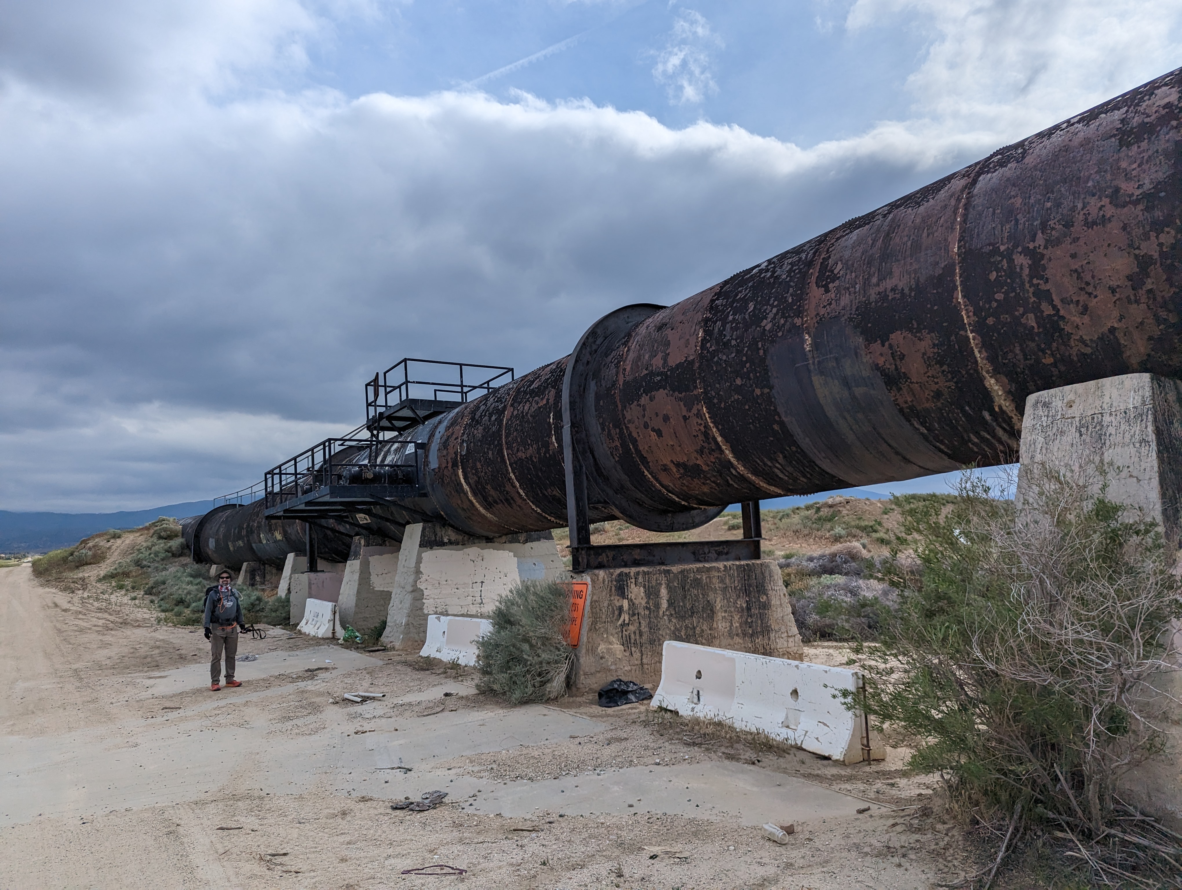
Our next big excitement was the underground water tunnel all of sudden came out of the ground and we could see the top of a large pipe. We were excited so walked nearby to take a closer look. We even could walk across the top of the pipe which also offered the best vantage point to see everything around us in all directions which had mostly been hid from us on trail level as our view often blocked by foliage. We could see all the way back from where we started where the wind turbines were all the way further down the valley to our eventual finish point.
Looking down the valley the perspective really through us off. It looked like a village with a lot of houses clustered together however when we finally approached the where the village was it was just a lot of homes scattered about all with huge plots of land so none of the houses were really that close together.
At last, the tunnel which turned to a big spherical pipe flowed right over another totally open and different aqueduct. This was the aqueduct I had seen in the photos so as you can imagine I was ecstatic about finally reaching the "water". It's illegal to enter for water as probably too dangerous with the rapid water flowing, but it was peaceful to walk along side most of the rest of the way home. We were all getting tired and frequently checking our maps to see if we were almost home. We could kind of see where we needed to be so it was just on more left turn and follow the road about a mile back to where the day began at Hikertown USA.
The next wave of thru hikers had already arrived, set up camp and were gathered in a central area cooking dinner together. We had a long drive ahead back home so quickly loaded up the car, said our goodbyes and started our journey home.


No comments:
Post a Comment