|
December 5-6, 2020
|
Scissors Crossing to Montezuma Valley Road
|
|
Mile 77.3-101.2
|
|
|
[Mile 77.3-91.2]
|
Day 5: 5:32 (moving) / 9:08 (total)
Max 3,225 feet (+2,106 / -814) |
[Mile 91.2-101.2]
|
Day 6: 4:00 (moving) / 5:57 (total)
Max 4,440 feet (+1,099 / -1,073) |


Pacific Crest Trail – Day 5-6 (overview)
About every two weeks has been the cadence for planning a new section of the PCT. With two setbacks because of first fire danger caused state trail closures and then a second time because of cold/rain/snow/wind, I was running short on time in 2020 to reach my goal of completing the first 100 miles of the PCT.
None of the first four days were easy, they were all well earned badges to complete that section of the trail. Each of the first four days were able to be tackled in a single day, but not because of shorten day light window this next 23 mile section would have to be tackled over two days. Instead of a small backpack filled with basic supplies and loads of fluids this time a full pack with tent & sleeping bag, 4 meals on the trail, and warm clothes for the frigid December desert.
Again we would have to drive down from Los Angeles a day early to be able to be at the trailhead as early as possible. Because of the point to point hiking one of the question is always one or two cars? I reached out to Cowboy Dave and he was available this week to shuttle us to the start. So the plan this time was to spend the night in Julian where he would meet us Saturday morning and we would drive to the end of the hike together to leave my car at Montezuma Road, then be taxied to the trailhead for our start at Scissor’s crossing.
One of the usual concerns is weather. Is it going to be too hot, to cold, or this time too windy? My guidebook suggested that this section of the trail alongside the flats of Valley de San Felipe is typically windy and can blow hikers right off the trail. Thursday and Friday the weather was projected that the Santa Anna winds would kick up and blow strong dry air into the region. On top of the wind to worry about nights were expected to drop into the 20’s so it was already going to be cold even if there was no wind.
The other usual concern is water. There is no natural water source this time of the year but at mile 13 there is a water cache that is supplied by trail angels. The water drop off is on private land and the trail angels have rights to stock supplies, but no one else can access the drop by vehicle. I found a great trail water resource https://pctwater.com/ which contains a .pdf you can download and it has known water updates published. The last update was the first of October and it appeared there was plenty of water especially based on the small amount of hikers we’ve encountered in the first 77.3 miles. Just to double check I found an email address and asked for any updates and was pleased to get a reply that there were confirmed reports that the water was still in full supply even since the last update on the report.
One more thing to deal with was Covid and it was on the rise. There were even more California restrictions discouraging mixture of households, travel bans all except for essential travel, and even restaurant service scaling back and only offering carry out service.
Pacific Crest Trail – Day 5
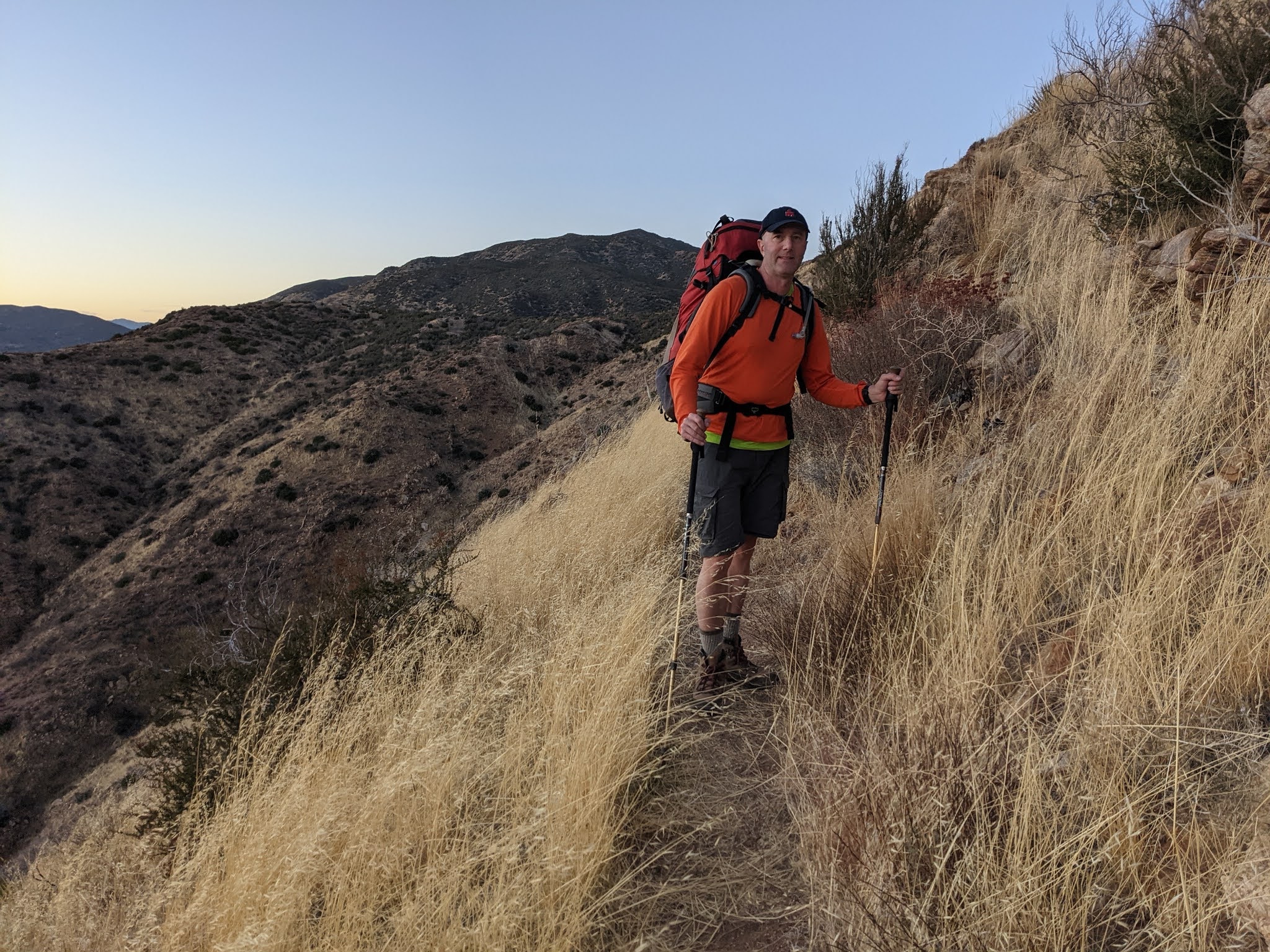
Every hike so far had been on a Sunday and we would drive down from Los Angeles comfortably Saturday afternoon. Because of a two day hike we would have to fight Friday night rush hour after work and get into Julian a little late. I stopped by to pick up Mai in OC. She had never backpacked and camped on a trail before and had just outfitted herself with all the essentials such as boots, larger backpack, etc. She wasn’t sure how to pack everything so before hitting the road we loaded her pack to make sure she wasn’t missing anything. I was totally excited to see that Mai had ordered official PCT baseball caps that we could wear to commemorate our 100 mile mark on the trail this weekend!
Once again the road to Julian was familiar. About Escondido we were both feeling hungry so I was able to talk Mai into trying Chipotle, my favorite, for her first time. I think she approved. On the way to the hotel, now of course already dark, we saw the temperature continual to fall. It was already in the 40’s in Julian which was reassurance it was going to be cold both in the morning as well as Saturday night in a tent on the mountain. While most of Julian was already closed for the night, after checking in to the Julian Gold Rush Hotel, a quaint little historic hotel, she realized she was missing some of her trail snacks so we walked down the street to the only place that was open, a small carryout where we found some great beef jerky and a couple of Snicker bars which would hit the spot over the weekend.
Our goal was to be on the trail between 8-9 a.m. The 6 a.m. alarm always comes too early and we had 45 minutes to get ready, have breakfast, and meet Cowboy Dave. He arrived ontime, actually 5 minutes early and I loaded up our packs in the back of his SUV. He’s always a jovial and a fun story teller. We figured out the best route to take and headed off down Banner canyon and turned at Scissors Crossing and followed San Felipe Rd all the way to Montezuma Road where we easily found the trail crossing and parked my car for the next two days and loaded into his truck for the shuttle back to Scissors Crossing.
He said there have only been a handful of other hikers he’s helped out since we last saw him in September for our first shuttle to the Southern Terminus. He did saw he had to pick up a girl that didn’t heed the weather warnings and she nearly was stranded in the snow near Mt. Laguna. A good reminder we made the right decision to postpone that weekend’s hike. One of the things we learned that he shared was that S. California Edison had shut of the power for most of the area for 2 days because of the high winds that we had been worried about. Thankfully, the weekend’s forecast looked as if the wind would die down.
On the way to the trailhead to hydrate I polished off a 32oz of Poweraid. My pack was loaded with another 32oz Poweraid, 3 liters of water, and a Mountain Dew. I would have finished almost every drop by the time we would reach base camp. We were dropped off and said our goodbye to Cowboy Dave. We basically just drove from the place where we needed to hike back to my vehicle so knew, especially with the large pack, it was going to be one of our hardest challenges on the PCT thus far. Last time we did 18 miles mostly downhill with light packs and finished right at sunset. This time was only 13 miles, but it was more or less uphill all the way there and with large packs we were hoping we could get there by sundown.
One girl was in the parking lot getting ready for a trail run and she took off in front of us in the same direction we needed to go. As we started the hike uphill it was apparent, we could lose all the extra layers and just wear shorts which would be pleasant for the hike all the way to camp. Within the first 1.5 miles we saw two separate hikers coming down the mountain. It was still pretty early so not sure where they started but packs were not terribly large so if they spent the night on the mountain they both packed lightly, or at least appeared lighter than our packs.
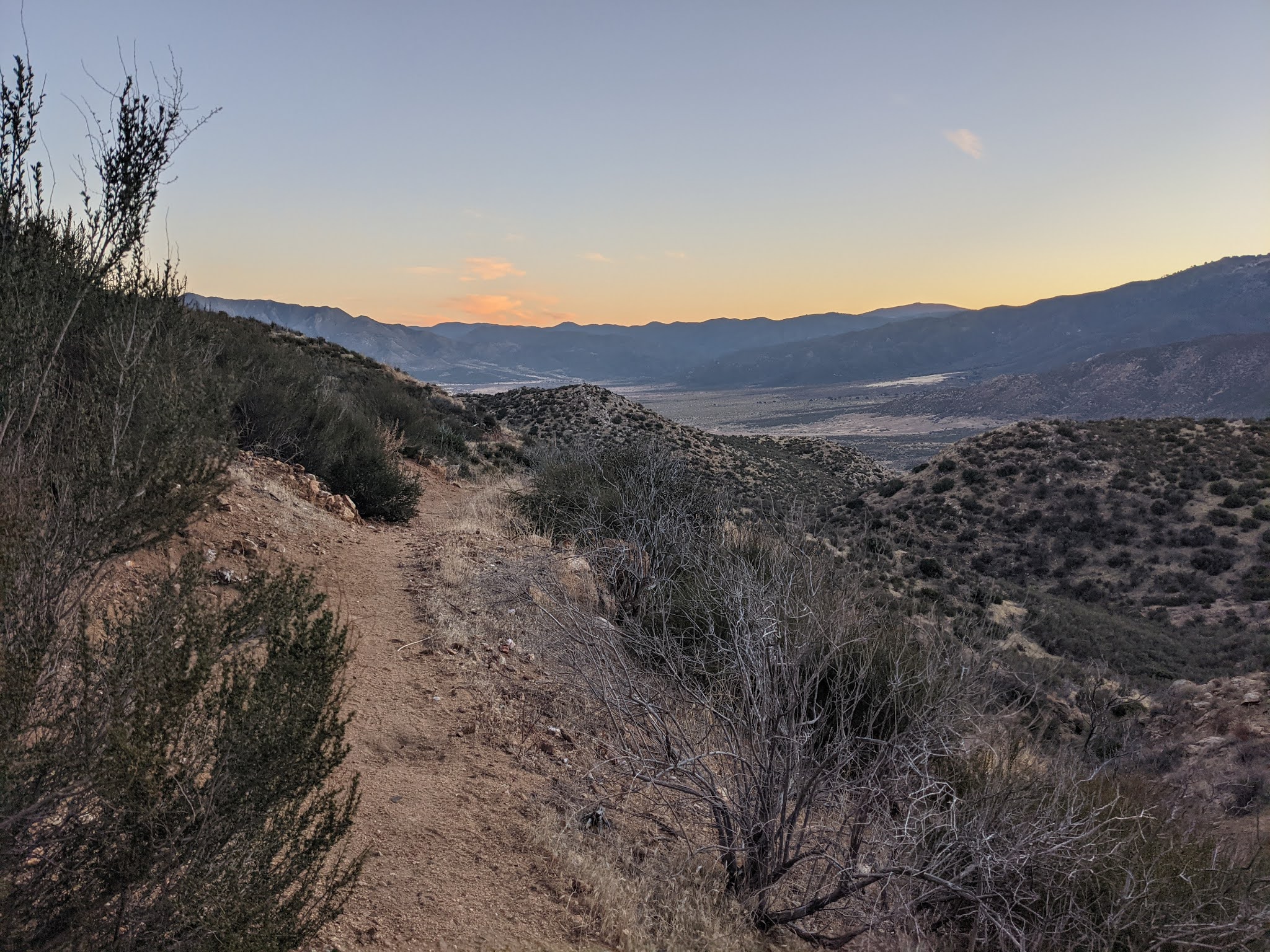
The first two miles climbed fast as soon the parking lot was off in the distance. The landscape was littered with cactus of all types. I didn’t realize we would have the view of the flats of Valley de San Felipe nearly the entire hike to camp. The best views were always behind us looking back upon Granite Mountain where we had just hiked around on Day 4 of the PCT. Our initial goal was to try to hike 1 mile between rest stops but we were both feeling strong and seemed we had a good cadence of every 1.5 miles before needed to stop. Each and every time the trail went in around another inlet it would come back out and you would get another view of the valley from a little bit higher elevation and a little bit farther away from Granite mountain.
We knew “gate 3” or mile 13 was camp. A little beyond camp on a side trail would be the water cache. Getting to camp before dark was the focus of the day. There are no crossroads on the trail so it’s 23 miles until you fall out the other side so the only way is turning back or just keep going. The girl that was trail running we didn’t know how far she was going. It ends up we didn’t pass her on her return to her vehicle until we were at mile 10, so she would have had at least a 20 mile run, if she made it to the water cache she would have run closer to 27 miles. We only had 3 miles to go to camp while she had 10 miles back to her car before dark.
There is always a question about the accuracy of millage recorded on my Garmin GPS. It seems is it shows farther than we’ve gone, so when it shows 13 miles and we are not to Gate 3 we really aren’t sure how much farther we have left to go. I remembered I started my watch at the parking lot and we had about a .25 hike to actually reach the trail, so that was a relief we should be getting close. Then there was gate 1 and gate 2, but it seemed to take forever to get to gate 3. Some sections have a lot of signage but from the trailhead all the way to mile 13 we hadn't seen a single PCT trail sign. The trail was pretty straight forward and no chance to get lost. The sun was already starting to set and the temperature starting to fall when we finally reached camp. There wasn’t a sole in sight, we had the entire mountain to ourself for the night.
We found the side trail to the water cache and noticed someone had carried a 2.5 gallon water jug from water cache to the intersection of the side trail there. We debated using the jug or leaving it there for someone else that may need it, but it was already dark so we didn’t expect anyone else would be needing it that evening. If we got our own water we would probably end up making a trip to the water cache at night for cooking and a 2nd trip in the morning to refill water for the 10 miles on the rest of the way to my car. It ended up coming in useful and took full advantage of it being left along the trail which also allowed us to get the tent together before it was completely dark.
The sun went down and immediate the stars came out in brilliant fashion. The moon hadn’t come up yet so already before dinner it was pitch black. I packed a Jetboil camp stove and we heated up some water for hot tea and to cook our dehydrated camp meals. We brought two for dinner, but only cooked a Thai curry chicken which we shared and filled us up. The first of two Snicker Bars was the perfect dessert. After dinner we enjoyed the stars for a little longer and then crawled into our sleeping bags for the night. I got up once in the middle of the night to go to the bathroom and this time the moon was out so the stars why still brilliant, were not as majestic as they were before the moon came out. There wasn't a sound of any kind all night, no critters running around, total quietness until the sound of a bird chirping when the sun came out.
Pacific Crest Trail – Day 6
It got real cold overnight and some water that was spilt actually froze. The sun woke us up and we made breakfast, again a dehydrated meal that we shared and it hit the spot. I had also picked up a banana shaped plastic holder that protected the banana from getting crushed in the pack so also had a fresh unharmed banana. The 2.5 gallon jug was the perfect amount for all of our cooking, drinking for dinner and breakfast and filling up each of our 3 liter water bladders for the 2nd day’s hike.
After we tore down camp and packed our backpacks, we had to finally make the hike down the path to the water cache to drop off the empty container we polished off and decided to pick up a fresh one to put back along the trail where we found the one we used. Also there was a secure plastic box that contained a sign-in notebook which we signed and thanked the hiker that had carried the jug of water out to the trail.
I paid closer attention to the trail guide for our first day of the two day hike and only remembered there being a climb at the beginning of the 2nd day, but for the life of me couldn’t remember how long it went on. Ends up from mile 13 to mile 19 it was a ruthless steady climb. At first there were more views of Granite mountain behind us but eventually turned away from the flats of Valley de San Felipe and at the top of the climb offered views of a new flat expanse of Montezuma Valley far below as well as the San Ysidro Mountains to the northeast. One thing great about the trail is that it’s never the same scenery for very long. As elevation changes or the side of the mountain you are facing changes so does everything that grows there.
The six miles with the heavy pack almost did me in and I started lagging behind. I always love being able to see where we were going and still with 4 miles to go there was no sight of Montezuma Road. It was good to have the hard part of the hike done and know the rest of the day was all downhill. We debated how to count the miles as we left camp. Were we at mile 14 for the weekend, 1 mile for the day, or mile 92 for the trip. We decided to go with the larger number so we could easily count down to mile 100. According to my watch we were exactly at mile 100 when Mai found white rocks organized so that they spelled out “ 1 0 0 “. She was so excited to reach mile 100 while I was just exhausted. We took a few photos without even removing our packs and ventured on.
Moments later after passing the 100 mile mark I caught my first glimpse of Montezuma Road which fueled my spirts and gave me new hope/energy to make it to back to the car while at the same time Mai started slowing down. The descent offered new scenery of green trees instead of cactus and eventually just before the road even some large trees. There was water at the end of the trail that could be filtered but we carried on towards the car where I had a Red Bull and left over Chipotle. I finally felt like I earned the 100 miles and put on my new PCT baseball cap and we snapped a picture with both of us wearing our hats.
As the trail continues, we constantly are getting to see new sights. The way home the GPS took us a whole new route through our first glimpse of Warner Springs and then onto Temecula down Rt. 79. I don’t know if I had ever been down this road before, perhaps one time on a motorcycle ride to Julian, but it made for a spectacular drive and looking forward to exploring it again next time back into Warner Springs for the last leg of the first section of the PCT that concludes in Warner Springs.


No comments:
Post a Comment