|
October 8, 2022
|
Cleghorn Road to Cajon Pass
|
|
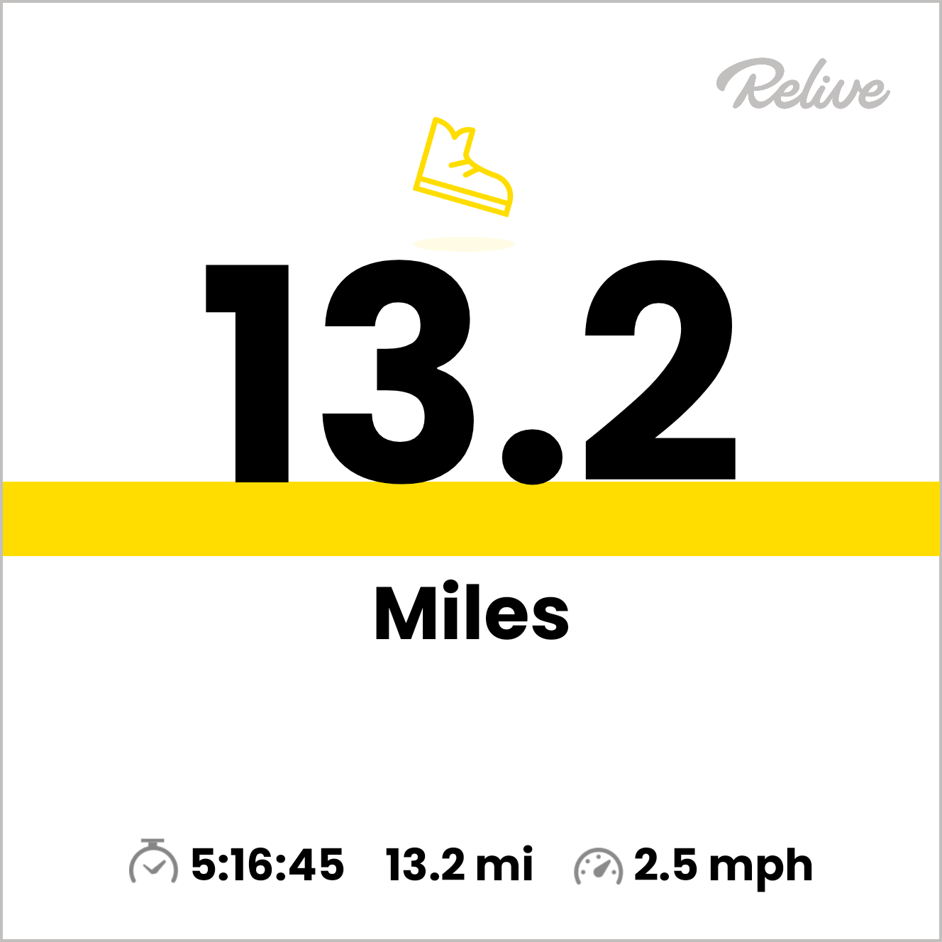
Mile 328.9-341.8
|
4:18 (moving) / 5:16 (total)
|
|
|
Max 4,135 feet (+1,637 / -1,976)
|


Pacific Crest Trail – Day 24 It's always great to be back on the PCT. While it felt more like summer, the weather on this beautiful fall day was absolutely beautiful offering clear blue skies in the morning and a few clouds rolling in the afternoon.
Most of our PCT section hikes are contiguous and we start where we left off, but for this hike we had so make a last-minute change to our plans. Our previous hike ended in the Big Bear area on a back country road called Polique Canyon road. The next section (or Day 21) was supposed to be 21 miles, however, we learned that the road to access the trail at the end of this hike had been closed for some time.
While we had a hike planned for nearly a month, of course, most of our planning happens earlier in the week prior to our hike. After reaching out to the San Bernardino National Forest Service (Mountain Top Ranger District 909-382-2790) we learned we couldn't just do the section we had intended because the road to Splinters trailhead was closed. This would require a new strategy, most likely a 2 day 1 night backpack. Road closures: https://www.fs.usda.gov/detail/sbnf/conditions/?cid=FSEPRD538928
We discussed a couple alternative hikes, the first was an easy day and perhaps only 6-7 miles on the PCT and to enjoy the Deep Creek Hot Springs, however, OoBrianoo, wanted to get more out of driving a couple hours each way and suggested we skip ahead and do the final segment of Section C which quickly became the new plan. The hike would be rolling hills of a little over 13 miles.
This would leave us with 50 more miles as part of Segment C of the PCT to backtrack and complete. I feel time is running out in 2022 as it seems that fall/winter weather will soon be rolling in and most of the remaining miles left to cover I would expect to be in the 6,000 - 7,000 feet range so especially the longer we wait we will have to deal with a little chill.
Mai & I has just spent an entire weekend away from our children so two weeks in a row was going to be hard for her and so understandably she would sit out this section. She's been with me from the start so it's really hard to plan a hike knowing that she will be missing out. This meant is would only be OoBrianoo and I for this section. It seems we always have to negotiate a start time as he's a much earlier riser than myself. He suggested meet at 5 a.m., I suggested 8 a.m. and lucky for me the park where we would stage a car at the start of the hike didn't open that early so we both got to sleep it a little bit.
Mai surprised me at mile 100 with a PCT hat which I've treasured. Mile 200 we really looked forward to and got OoBrianoo a matching PCT hat. Now mile 300 was quickly sneaking up upon us. Ironically, it was actually exactly one year ago we passed mile 200. We have unofficial trail names so I thought about ordering a set of PCT shirts and having our trail names put on the back. I placed an order which arrived the very next day. I was excited to have them complete, so before the weekend I found a place nearby that can put the letters on and had them finished the following day and looked forward to surprising Mai and our trail companion OoBrianoo.
Usually getting to the trailhead is a journey, but I'm excited to share that at least the end point of our hike (which was the meeting point) was the closest of any trailhead from my home, only a 49 minute drive. The PCT intersects with the I-15 adjacent to a McDonalds, perfect for any thru hiker to make the easiest stop anywhere along the PCT, but I already had breakfast so drove directly to find parking.
There was a lot of activity at our end point and a few gentlemen setting up a tent next to a couple monuments. Ends up after talking with them for a few minutes this location was formerly part of the original National Trails Highway which later became Route 66. I learned a lot about the history as well of a flood that washed out the whole area covering it in four feet of mud. The site has been reconstructed and there are a couple monuments with a flag and a kiosk with historical information. The guys we hosting a get-together for the historical society. Also warned me of snakes that like to visit the area. Yikes.
I ventured on down to the PCT a short distance away and saw the little canyon we would exit later in the afternoon. A few minutes later Oobrianoo arrived, and we hopped into his car and headed to Silverwood Lake park our starting location for the days hike. I was a scenic drive mostly because I had never headed east on this section of St Route 138 ever before, so it was new territory for me to see. We arrived at the park entrance and paid a $10 fee and were directed to the day use area for parking which offered easy access to the PCT.
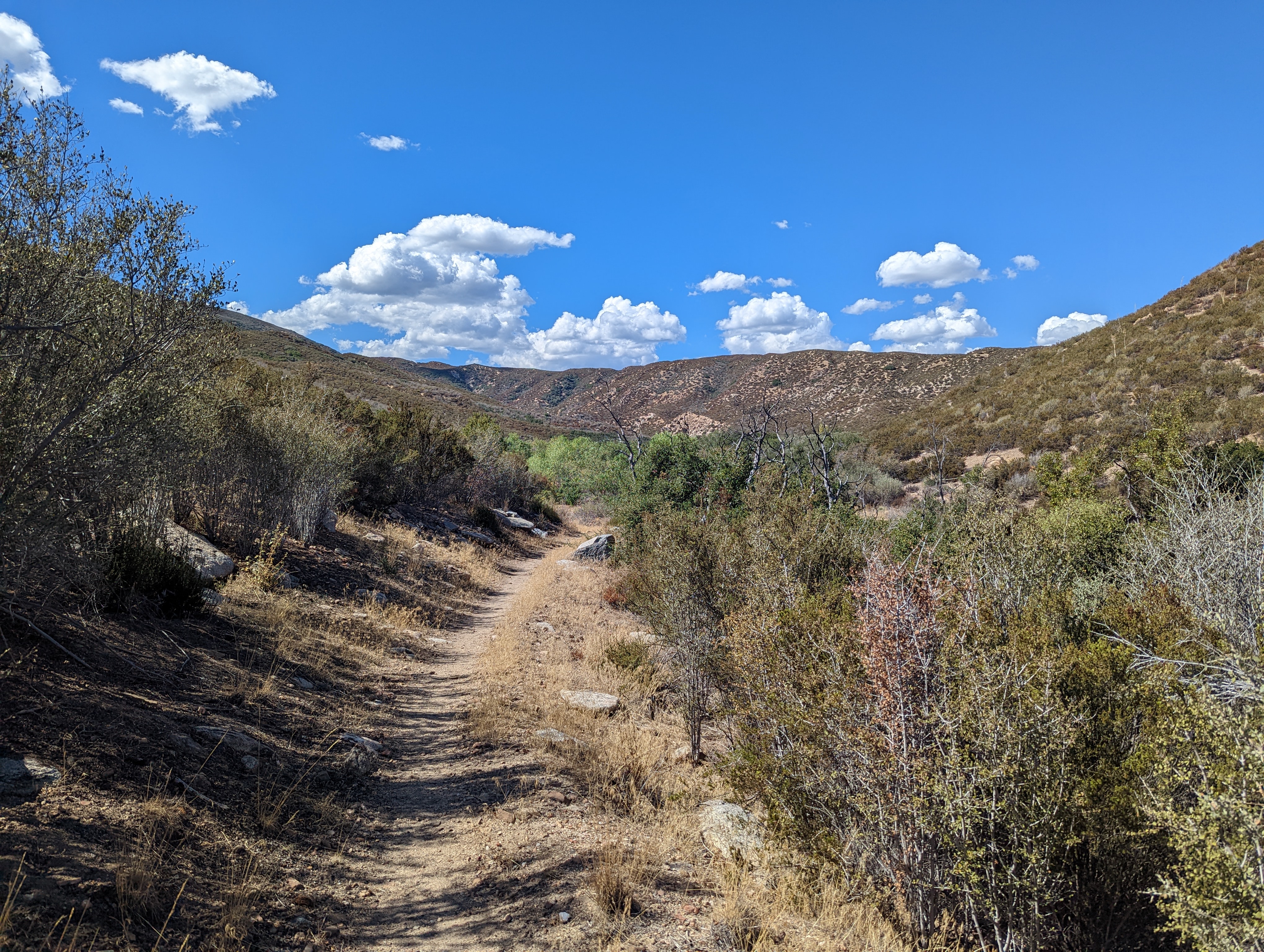
Conveniently located adjacent to the parking was a clean bathroom/toilet so I made quick stop and before heading out for the days hike. Juno my Austrian Shepherd has hiked several sections of the PCT and today the trail seemed ideal for him to join us. We had passed a PCT sign on the drive to the parking area so backtracked on foot and found the trail. At first I wanted to head the wrong way and Oobrianoo quickly pointed out that we needed to go in the opposite direction. Once we got that figured out we walked under the State Hwy 138 and easily picked up the start of the trail.
The day would have 2 climbs and two downhill sections including downhill all the way to the car on the opposite end. It didn't take long for us to begin our first upwards climb. Soon we could look over our shoulder and see the lake already far in the distance as well as a great view of it from above. With 13 miles of hiking for the day we agreed maybe mile 7 would be a good place for lunch. Oobrianoo also suggested to look out for snakes and for some reason Juno and I mostly lead for the day so we would be the first to encounter any along the way.
We were just far enough away from State Hwy 138 most of the day that we could hear no sounds of cars. We could see the road a couple times from the higher points along the trail, but for most of the day were completely isolated from the rest of the world. We saw a couple of homes/farms off to the right that are hidden in the mountains. Even one home on top of a hill in the middle of nowhere not far off of the trail.
We kept looking at our GPS to track progress and were knocking off miles one at a time. As usual we guessed how many people we might see along the hike. Oobrianoo thought we might have a few hikers coming from the other direction that just ventured down the trail from the I-15, however, no hikers. I noticed tracks in the often-sandy terrain especially on the edge of the trial and at first thought they might be horse tracks, however, after closer examination the tracks were on each side of the narrow trail and I later suggested it was simply the marks from hikers using hiking poles.
We passed a few spots that seemed as if they would be excellent camping spots however in the summer/fall with no water all the creeks were bonedry so all the hydration needed for the day had to be lugged from the start of the hike. Juno was exited to lay down in the shade when we stopped for lunch as there wasn't a whole lot of places to get out of the sun the entire day.
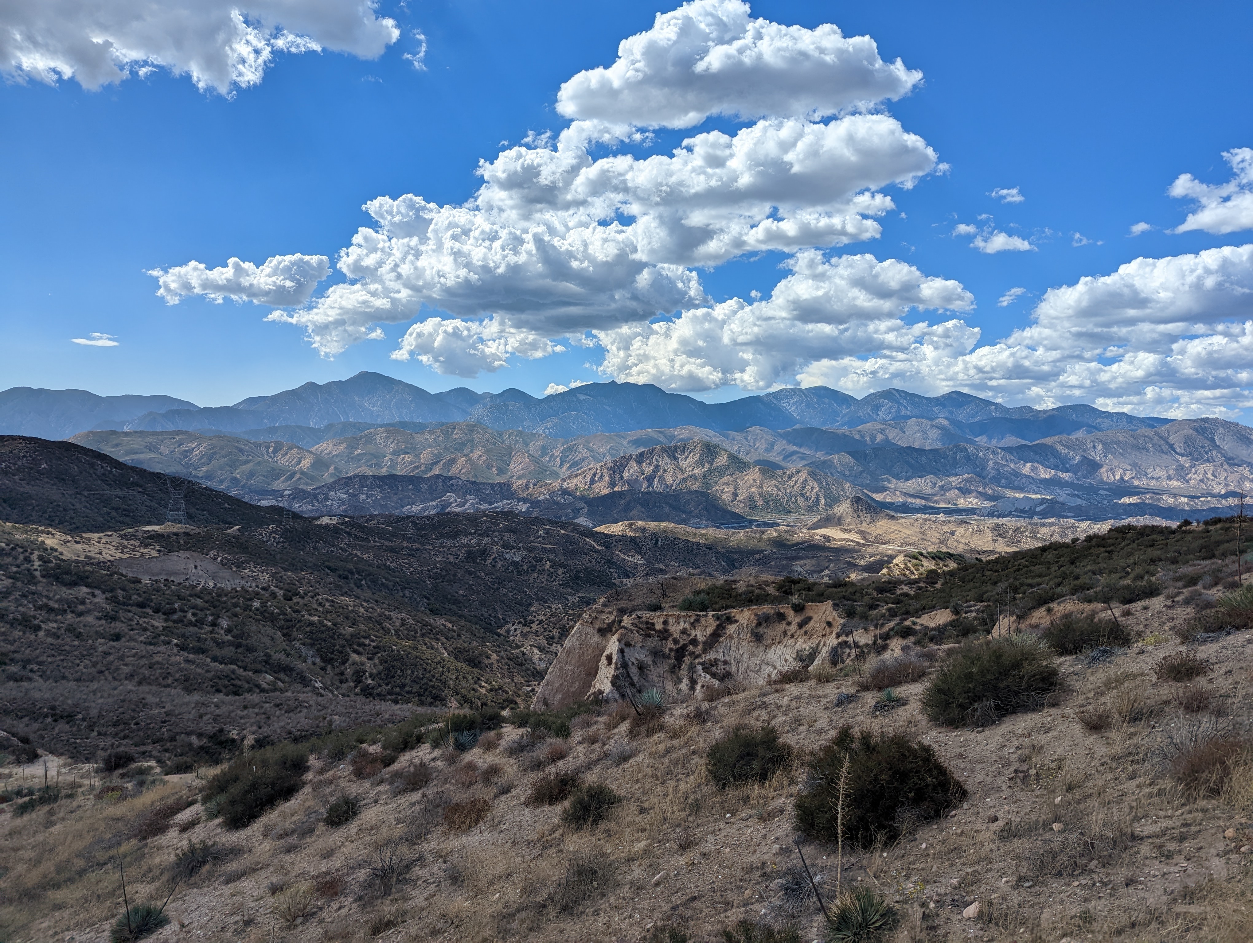
Really there wasn't anything spectacular along the first half of the hike, however, every step we took we got farther away from the San Bernardino Mountains and closer to the San Gabriels. We started to have great vistas of the San Gabriels. I can stare at this same mountain chain from home, but I live on the south side, so it was fantastic to see the ridgeline of the entire mountain chain from the opposite direction. The peaks were all clearly visible from Pine Moutain, Dawson Peak, Mt. Baldy, Ontario, Cucamonga, and Etiwanda peaks.
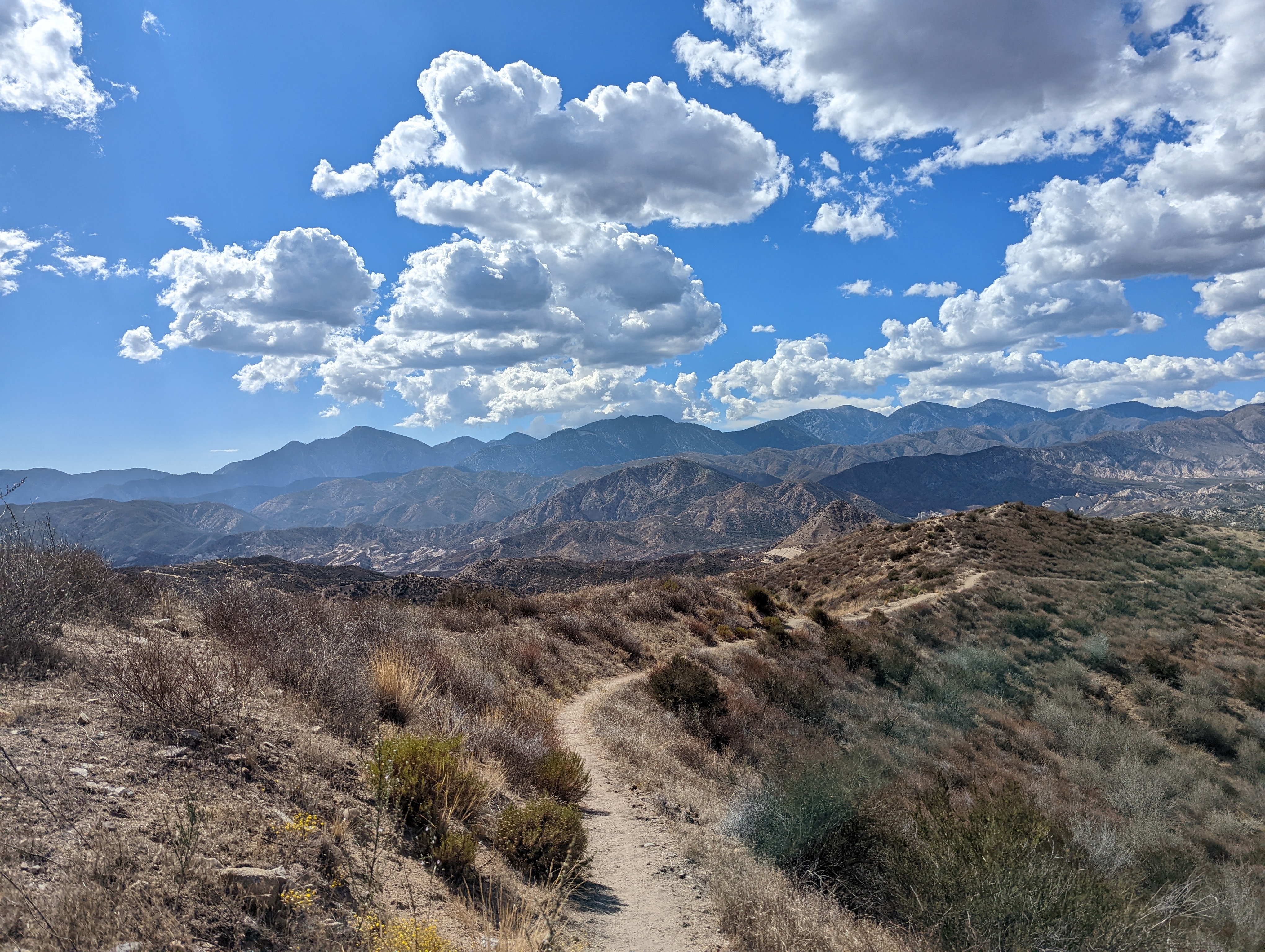
The day started out pretty clear, but as morning faded and afternoon rolled in so did new clouds which made for great views and even occasional cloud cover with a little shade when there wasn't a single tree anywhere in sight. We crossed a dirt road that looked as if a road to access the powerlines that passed thru the area. Just past the powerline we began to make another climb and that's when the rest of the hike got more interesting. We soon came upon a ridge with a shear dropoff on the opposite side. A little scary standing on the edge and looking below.
The trail wound around to the right and we circled around the steep drops meanwhile the San Gabriels kept getting closer and the views continued never to disappoint. Probably 10 miles into the hike and only 3 miles to go we start to look for landmarks to see which direction we will continue to find our car waiting for us at the other end. A couple times were were thrown off by Hwy 138 and a railroad which initially were mistaken that we were close to the I-15, but the trail takes a hard left-hand turn, and we can see we don't have that far to go. The biggest landmark I recognized by the finish was a steep hill with a peak that stood out just north of the McDonalds. Later I would look up this hill and learn it's called Wye Peak.
It ends up the only people we saw on the trail were two characters in the distance with bright orange shirts. At first, we were puzzled. Were they hikers, rock climbers, surveyors, construction workers? The closer we got we saw a big deer head in a black silhouette on the front of their shirts and ends up they were deer hunters. We were unsure if they hiked in from the end of the trail or accessed the area, we saw them through a one of the back country dirt roads we passed.
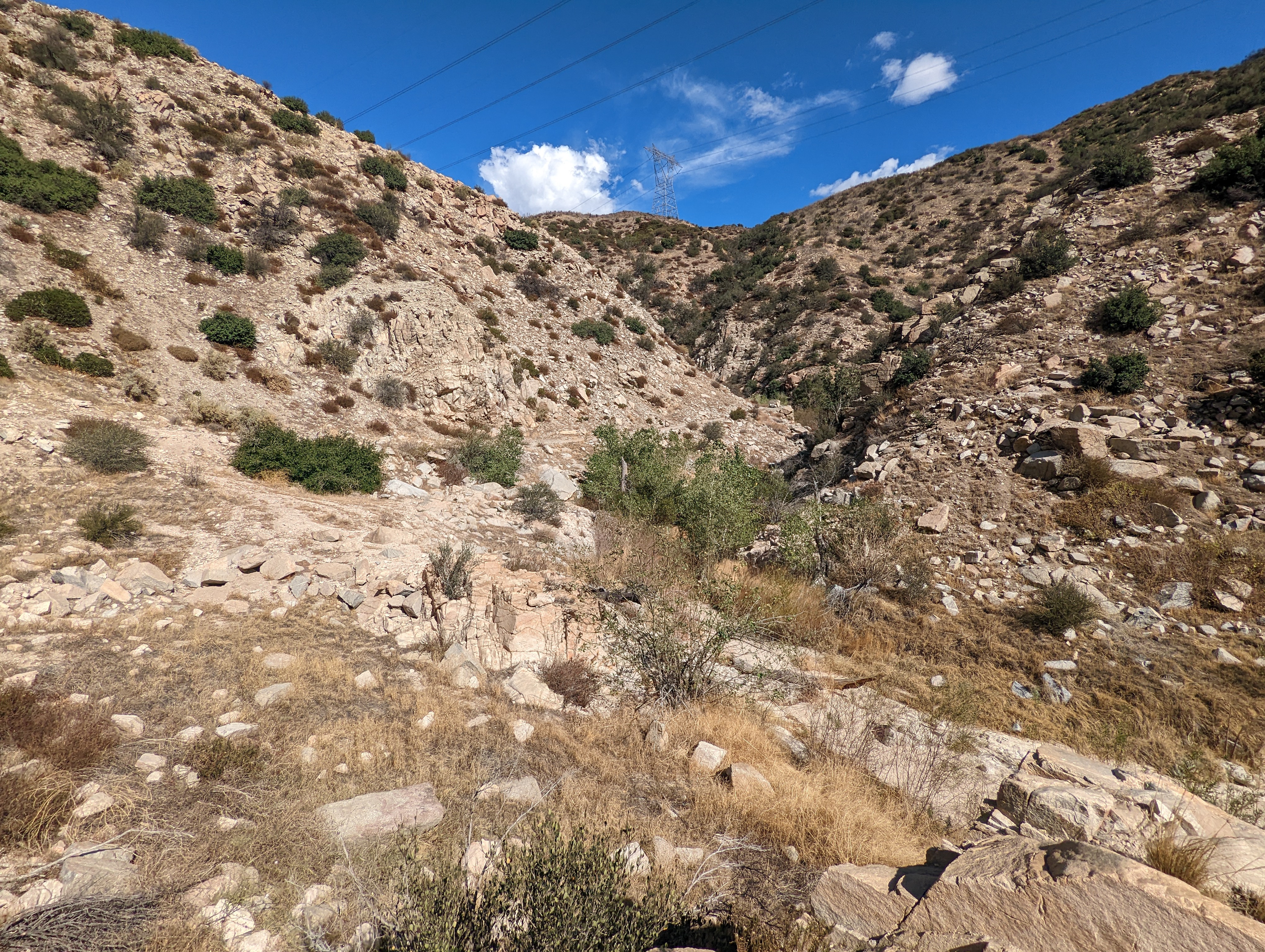
After the great vistas we once again started heading back downhill and then couldn't see as far as we were getting deeper and deeper into a narrow slot canon which once had a river cut through the mountain. We agreed we must come back in the spring if there is water flowing it would be magnificent. The trail hugs the right side of the canyon wall and in parts even appeared to be paved. Ends up the pavement is the remnants of the 1 lane road that used to be Route 66. At the very end of the canyon were even remains of the cement walls that once supported a bridge over the river.
At last we made it out of the canyon and could see that our next hike from this point would go under I-15. We were happy to see our friends we met in the morning from the historical society cleaning up from their day and they were excited to see we made it all the way there before they left. Now that stop next door to McDonalds was sounding fantastic and so I picked up a chocolate milkshake to enjoy on the 20 minute drive to pick up our 2nd car at Silverwood Lake Park.


No comments:
Post a Comment