31st High Point Visited
7th Highest State Highpoint
7th Most Difficult
summitpost.org
wikipedia.org

It's been an interesting couple of years. I finished my 50 state marathon quest in 2017 and now left with another one of my goals of chasing down a few more state highpoints. My marathons had always taken me to new places and when appropriate it was always fun to try to kill two birds with one stone and knock off a high point while nearby for a marathon. Since my last marathon I've had two destination state high point conquests. In 2019 was Katahdin in Maine followed by a year off in 2020 because of Covid.
If one high point a year is realistic, I feel I'm back on track with Guadalupe Peak in September 2021 and the next destination in the works for 2022. It was a tough choice between Wheeler's Peak in New Mexico or King's Peak in Utah, each 13'ers. Wheeler's Peak would have been the easier choice, but with my other recent long hikes of tackling the PCT section by section I was getting used to long days/millage on the trail. Additionally, all of my PCT 2022 hikes have been around Big Bear, CA so I was getting a few more chances to get acclimated to heights greater than wear I live a sea level which would help for preparation of a long hike of a 13'er.
As luck would have it all of Mai's best girlfriends had chosen a destination marathon in Salt Lake City and she was looking for an excuse to see a new state, in this case Utah. It would be impossible to run a race a couple days before a long hike so I did my best to convince her just to travel to Utah and we could see her friends the night before their race and we could head out on Saturday after our own adventure. She liked the idea and as early as February we found round trip tickets for $127 each so I jumped on the deal and the trip began to get some momentum.
Looking at the details to climb King's Peak it was 28.8 miles round trip so it would be a really long day or better yet, we could make it a 3 day climb spending two nights on the mountain with a summit on the 2nd day. The weather for King's Peak is best in July/August but May and September are also doable. Fingers crossed the weather seven months later would be clear and we could get a green light to make a summit bid.
Mai partook in her first state highpoint a year ago with me for Guadalupe Peak in Texas, so she had a little idea what to expect, but left most of the planning up to me. While Guadalupe Peak at 8,750 ft was only a hard one day hike, to climb King's peak at 13,534 ft was a whole new ball game and required a little more preparation. In 2022 to date we had spent 6 days on the PCT including a 2 night 3 day 33 mile backpack. I couldn't have asked for a more grueling trip to prepare for King's Peak, however, this was in March or 6 months before King's Peak. It was a good learning experience of back packing in the wilderness, but most of the cardio benefits would be worn off by September.
Therefore we had planned a couple more hikes specifically to prepare for hard days and higher elevation. Besides two more PCT section hikes in the Big Bear area in July we planned a really tough 3 peak hike in the San Gabriels. Our plan was to hike Mt. Baldy from the back side climbing Pine Mountain (9,648), Dawson Peak (9,575), as well as Mt. Baldy (10,064). For extra credit I even threw in W. Baldy (9,988) then on the reverse got to cross all three peaks again back to the trailhead. Total ascent for the day was 5,154 over only 8.35 miles made for a grueling hike. Mai was a little out of shape but she pushed herself and made it through a long/hot day.
The next hike planned was a trip to the Sierras in August which would have been ideal to help prepare for the altitude of Kings Peak, however, my hiking buddy Mike had to reschedule so we ended up cancelling our plans. The last hike to prepare took us back to Big Bear August 13th for 12 miles mostly at 7,000-8,000 ft. Extra credit was thrown in towards the end of the day and Bertha's Peak (8,201) was added to the mix which also added an extra 2 miles. Unfortunately, Mai couldn't make it for this hike and missed out on some valuable fitness only a few weeks before our Kings Peak hike.
Giving Mai's lack of training we had one more chance to test her fitness the last weekend of August where we have done a about a 10 mile hike on the coast at Laguna Coast Wilderness Park. Not great for elevation training, but the loop we did had excellent vertical gain and she made it up the steep climb like a champ. It's also a hike we did on our first ever date 2 years ago and once again both on our 1st and 2nd anniversary. As the trip leader I had to make a lot of judgement calls for this trip. The first one was whether or not to abort, however, with all the hikes we've done together over the last two years she has endured. She has a cute saying and calls herself "durable". Not fast but long lasting like the Energizer Bunny.
We had everything perfectly planned so come travel week the last obstacle was only the weather. A week out the weather report changed three different times. At first it was going to be cold, then a heat wave hit S. California and must have carried inland and all of a sudden, the temperatures were to be in the 70's which in September you couldn't ask for anything better. Finally, the last concern was of rain. Originally rain was forecasted for Monday, but a few days before our flight the forecast was once again updated and the rain was not to arrive until Tuesday, a day after we should be off of the mountain.
The plan was to fly into Salt Lake City Friday and head to the mountain Saturday morning. Everything was going as planned but even though our flight was on time with an hour time difference we didn't land until 8pm and buy the time we picked up a rental car it was already getting late. After 9pm there were not a lot of restaurant choices, but Mai found a place on Yelp that was off the chain with great Mexican food called the Red Iguana not terribly far away and also on the way to the hotel.
We had to make a lot of judgement calls all weekend long and the first was whether or not to get supplies (especially a gas cannister, which for obvious reasons couldn't be checked on the plane, for my JetBoil) at night or wait and get in the morning. A theme for the weekend is making the choice that adds to the length of each day. We had about a 3 hour drive to the trailhead on unfamiliar roads and my original plan was to be there by noon, however, after no urgency getting out of the hotel early in the morning and picking up a few needed things at Walmart is was already looking like we wouldn't make it to the trailhead until at least 1pm where we still needed to unpack our camp gear and backpacks from duffels and properly pack our backpacks for 3 days supplies.
I've been to Salt Lake City a couple times to ski, however, I've never experienced the mountains there in the summer so was greatly looking forward to exploring. Kings Peak is located in the Uinta Mountains and more specifically within the boundaries of the High Unitas Wilderness. Interesting that a brewery with the same name we walked by at the airport the night before! According to Wikipedia, Kings Peak is generally regarded as the hardest state highpoint that can be climbed without special rock-climbing skills or guides. The easiest route requires a 29 mile round trip. Are you ready?
Interesting enough most of the drive is through Wyoming to get to the trailhead. Before leaving the paved roads there were some fantastic rock formations along each side of the road that were very unique and I'd never seen anything like them before. I don't know the exact distance, but about the last 20 miles to the trailhead are back country forest gravel roads. The roads were well maintained, and we could dive 35-45mph most all the way to the trailhead. We passed pastures of cows and a heard of some kind of deer.
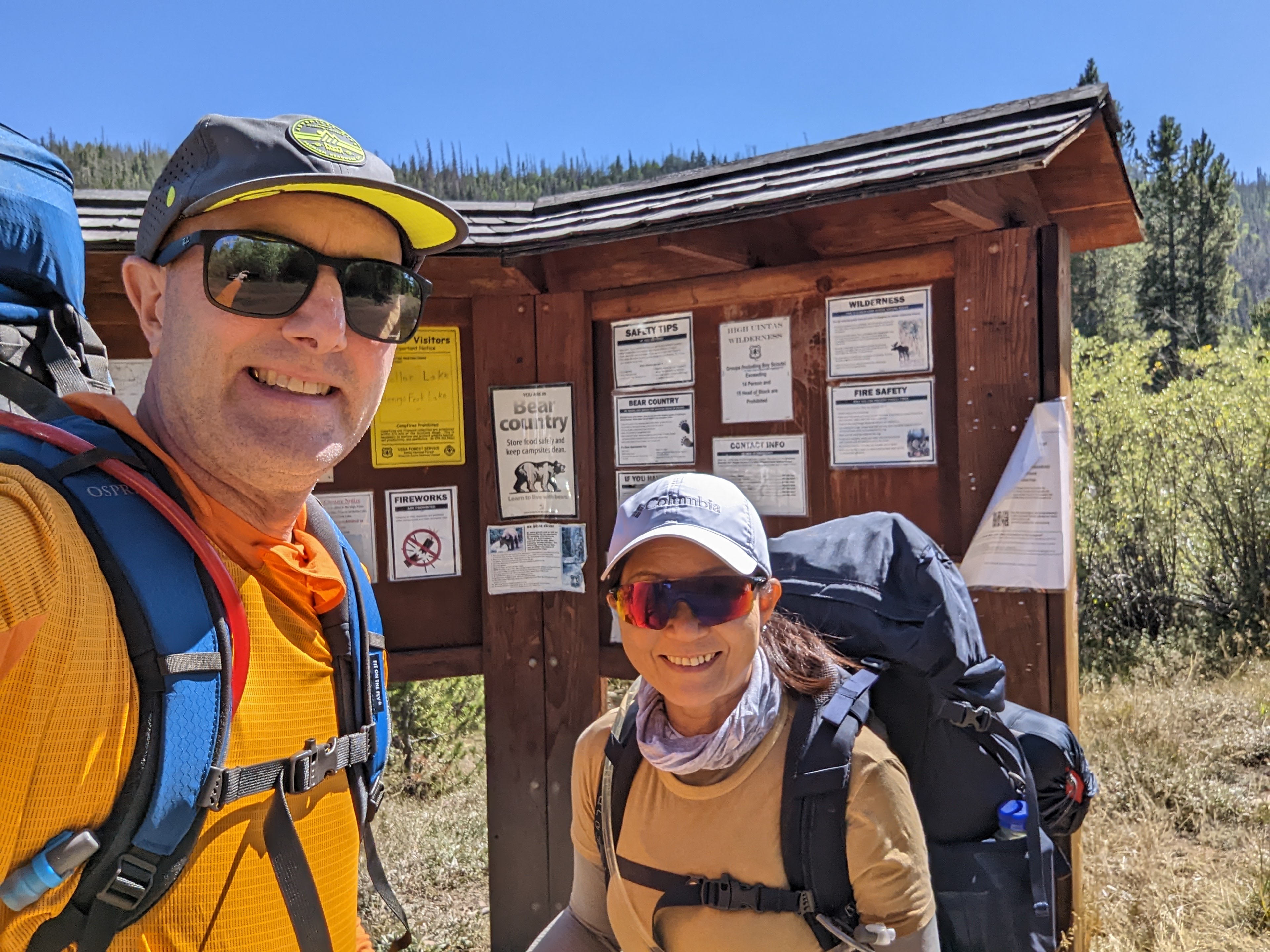
We've become accustomed to guessing how many people we would see on the trail so on the drive I asked Mai what she thought, her guess was 20. I opted to wait until we got to the trailhead parking and I would make my guess. I think July and August are the two most popular months, so the middle of September was already getting toward the end of climbing season, but because of the great weather I was optimistic we wouldn't be the only ones on the mountain. When we arrived at the trailhead I was astonished of all the cars. We were already in the middle of nowhere and hadn't seen another car and then upon arriving we found that nearly every possible parking place was already full. There were 3 lots and every spot in lot 1 and lot 2 were full. Lot 3 was a little further away, so I circled around 1 more time and found that we might be able to squeeze the rental car in-between some rocks and a parked car. Only a little scraping underneath as we slowly moved into the spot.
There were a few others in the parking lot already ahead of us with their packs loaded and making their way to the actual trailhead. We tinkered with our gear, filled up water bladders/bottles and seemed like it took nearly an hour before we were ready to hit the trail. Now already 2pm we were going to be luck to make it to base camp in the day light. My hope was to make it about 8 miles and camp near a lake. As we made our way from the parking lot we saw a several trail runners with super light packs that had just finished the 29 miles round trip journey in a single day. It seemed as if running the trail was taking them 7-12 hours where our slower method of two nights camping on the mountain would take us 3 days.
One last delay, we figured out that Mai's water bladder valve was malfunctioning as it had been damaged and the bite part missing so her water was dripping all over. This was a big dilemma and would make keeping her hydrated a lot harder. Not only harder, but we would end up sharing my bladder so I wouldn't know exactly how much fluids each of us consumed.
At last we were off, signed the hiking register at the trailhead and began our hike. With backpacks our goal was to hike 1 mile and take sit down for short 5-10 minutes breaks all the way to our campsite. We were passed by a few solo hikers that started after us moving much faster as well as hikers that had summited on earlier in the day and were on their way out.
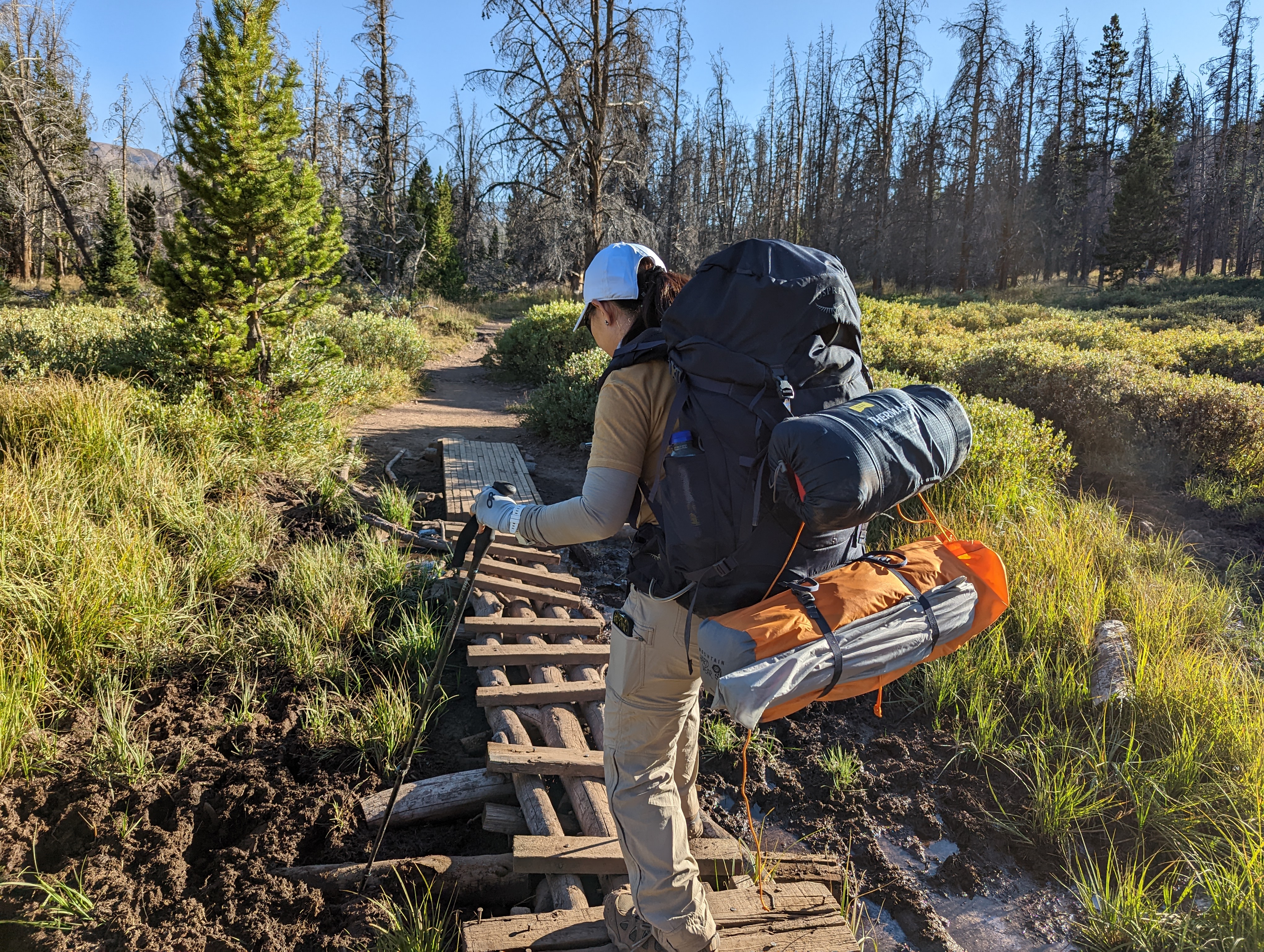
We passed three more groups on their way out and asked them for estimates on the distance to the first lake and got 3 wildly different answers. None of them as short as we wanted to hear! We slowly trudged on and realized that we could not make it to a lake by sundown but recognized the importance of camping near water, so upon making the first stream crossing across a narrow beam high above the water we had to make our 2nd judgement call. Should we stop and camp near the river or continue probably 2 more miles to a lake which could take us well over another hour to reach? With all the cars in the parking lot I was afraid we might not easily be able to find a camp spot and in the dark all the harder.
We agreed camping by the river would be more peaceful with fewer hikers nearby and decided to make camp. The spot we found was a little rocky, but I thought we could make it work. We worked together well and set up camp pretty quickly. This was our 3rd backpack together so we each were figuring out how to work together to be the most efficient. I filled up water bottles for the next day and for cooking dinner while Mai got everything in the tent situated.
While the weather during the day was sunny and warm (70-80's) I knew night was coming and that would all change. After the sun disappeared the temperature started plummeting and soon the only place to be was inside our sleeping bags. I had read about a little trick recently to boil water before bedtime and fill a Nalgene bottle with the hot water. It could be taken into your sleeping bag and would keep you a little warmer all night. It dipped into the mid 20's so where all the other water bottles were frozen in the morning, the one that was hot in the morning did not freeze.
While I thought our tent was far away from other campers it was actually not far off the one trail that leads to the summit. After dark and well after we had tried to fall asleep there were multiple hikers passing by in the middle of the night. I found it strange they were up so late. (this should have been intuition we would be in for a long day tomorrow) The night was cold and of course there were the multiple times in the middle of the night to get up to pee. It was an unbelievably bright full moon and nearly lit up everything. So bright it was even hard to see all the stars. (We would find the extra lighting would come in handy tomorrow!)
Each group we passed the day before we asked questions to gain whatever information we could gather that could help us in our quest for the summit. We camped very close to the bridge we crossed the night before and had talked to a girl that looked exhausted who had just come back from the summit and she said she was the "slowest" person in her group and it took her 12 hours round trip. We used that at "worse case" so figured if we started hiking by 8:30 a.m. at the latest we would make it back to our camp at 8:30 p.m. Not to mention the cold, camping at 10,000 feet makes sleeping a little more difficult and it's hard to get a good nights rest. I woke up early, filtered more water, made a hot breakfast of a Peak Refeul freeze-dried Breakfast Skillet with eggs, sausage, potatoes and peppers as well as some hot coffee to tri to lure Mai out of her warm sleeping bag so we could get it motion. It worked!
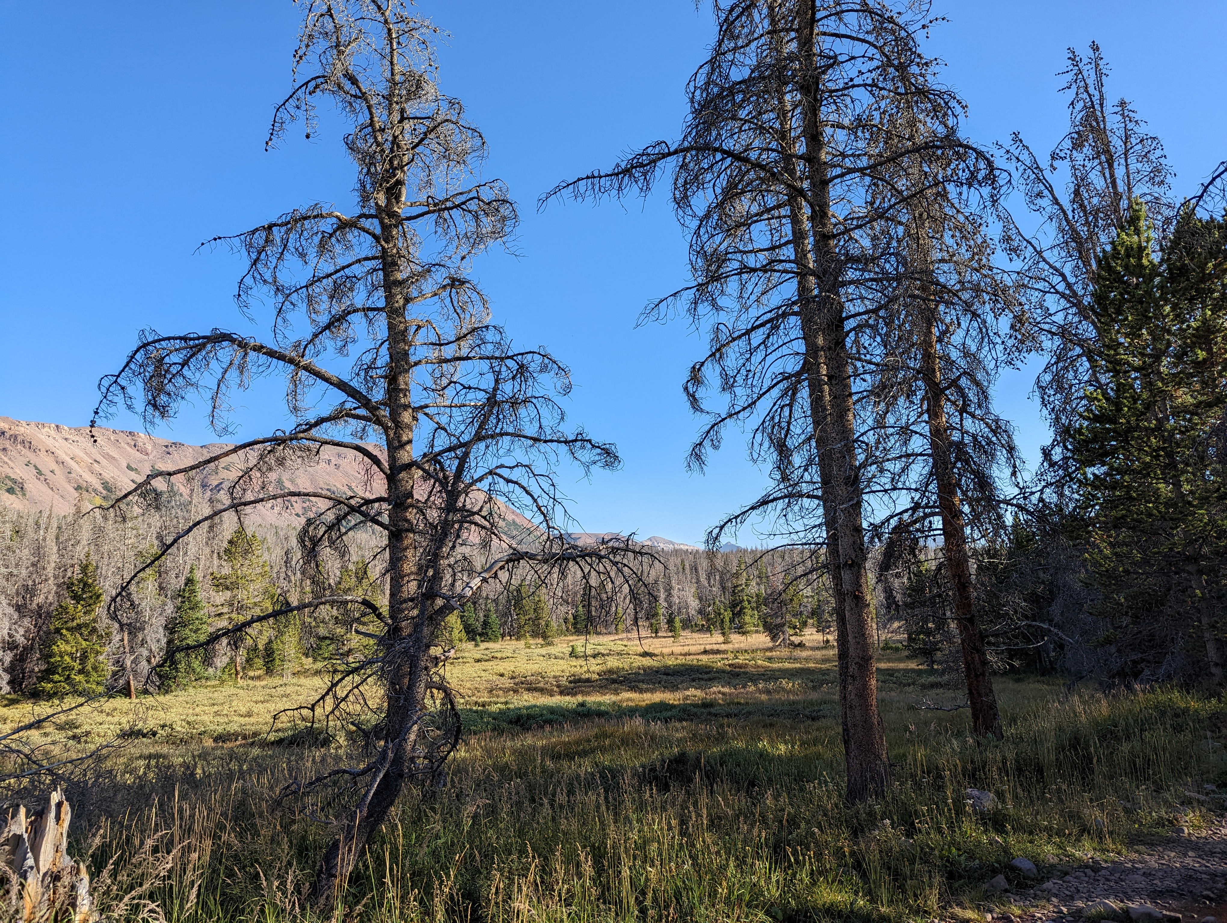
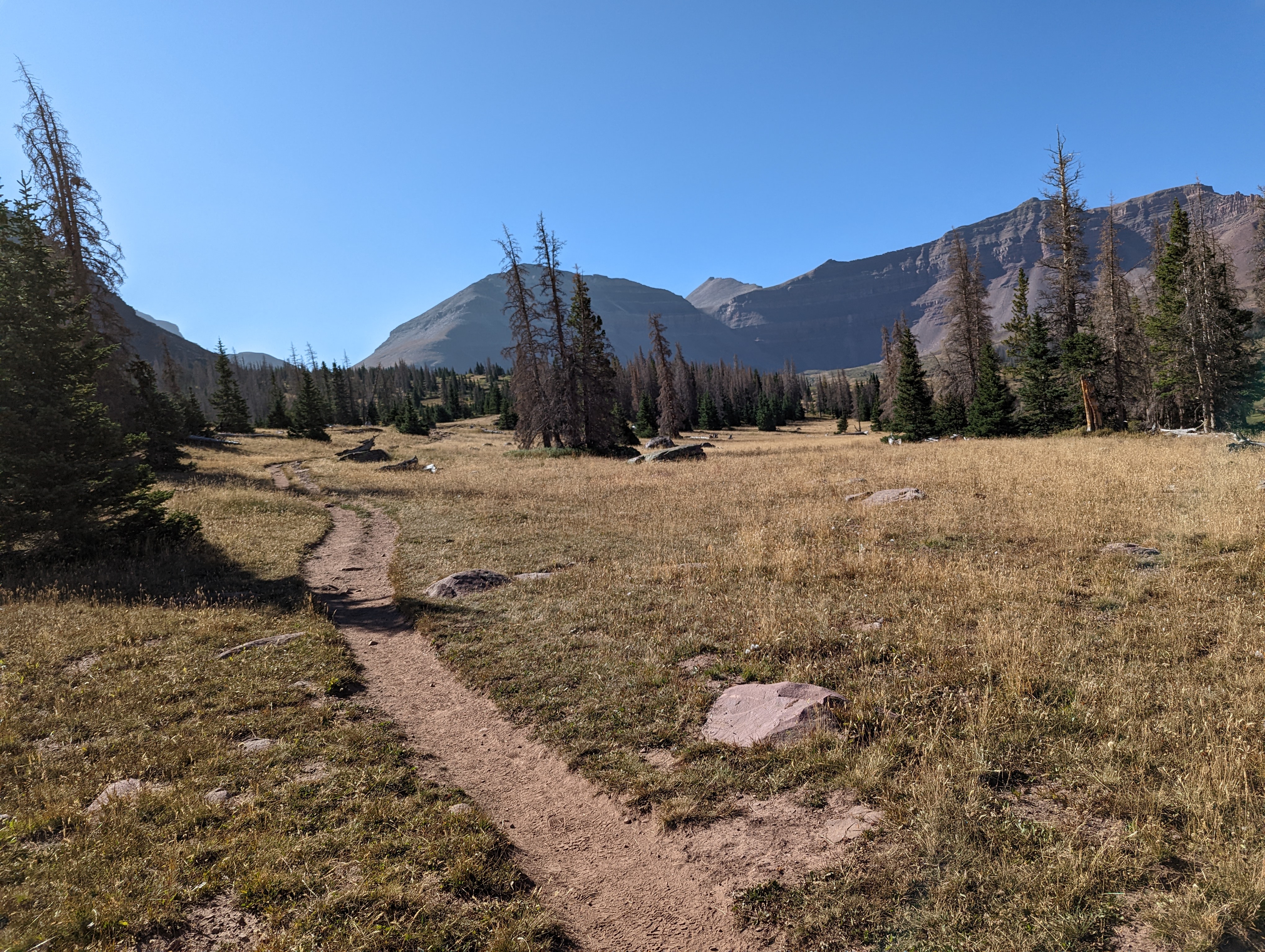
Mai packed a 2nd lightweight backpack she likes for day hikes with only the basics...food & water, gloves, rain coat, & headlamp. I didn't bring a smaller pack so had a pretty big pack for the rest of the day and filled it up with all the same plus water filter, emergency blanket, and first aid kit. We were off and so far "on time." We camped inside treeline, but has we continued up the mountain there were fewer and fewer trees and more wide open landscapes that were absolutely gorgeous. There were some waist to chest high bushes that littered the whole landscape. Moving along as fast as possible I heard a whistle, then again, and again. It didn't sound like a bird or animal so I motioned to Mai to stop and be quiet. We panned to our left and saw two guys with a better vantage point above us that were trying to signal us. I then noticed off to our left were a couple moose with full racks not far away. We admired them for a few minutes and then realized we were in no danger of crossing their path and kept moving.
We kept running into other groups that had already packed their gear and were heading down the mountain. Everyone it seemed had climbed on Saturday and now that it was Sunday were on their way out. It also seemed that most of them had come from Salt Lake City. The most memorable hiker we passed was a girl from Connecticut hiking by herself. She was impressed that I actually knew the name of the highpoint of Connecticut as well had actually been there!
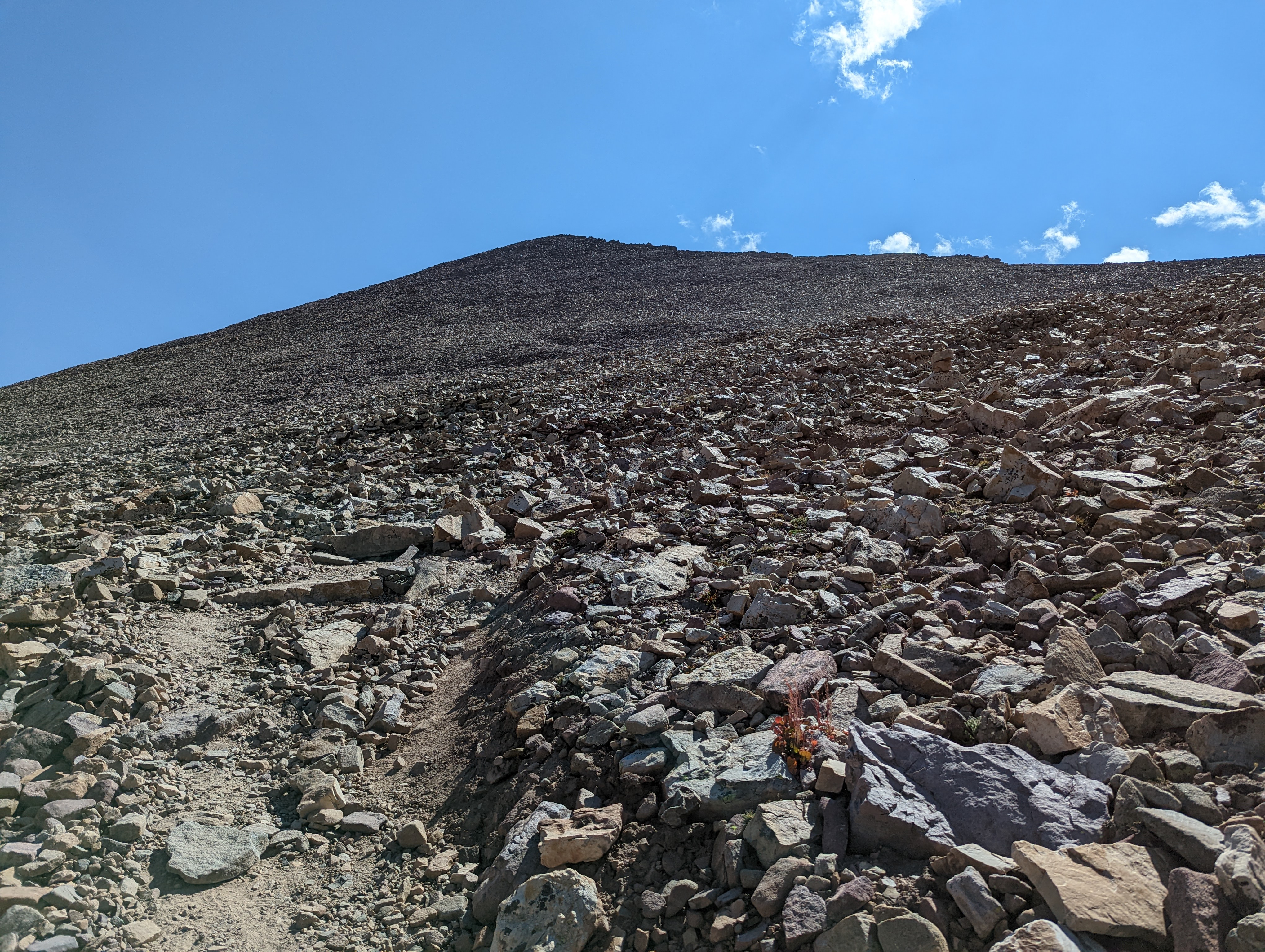
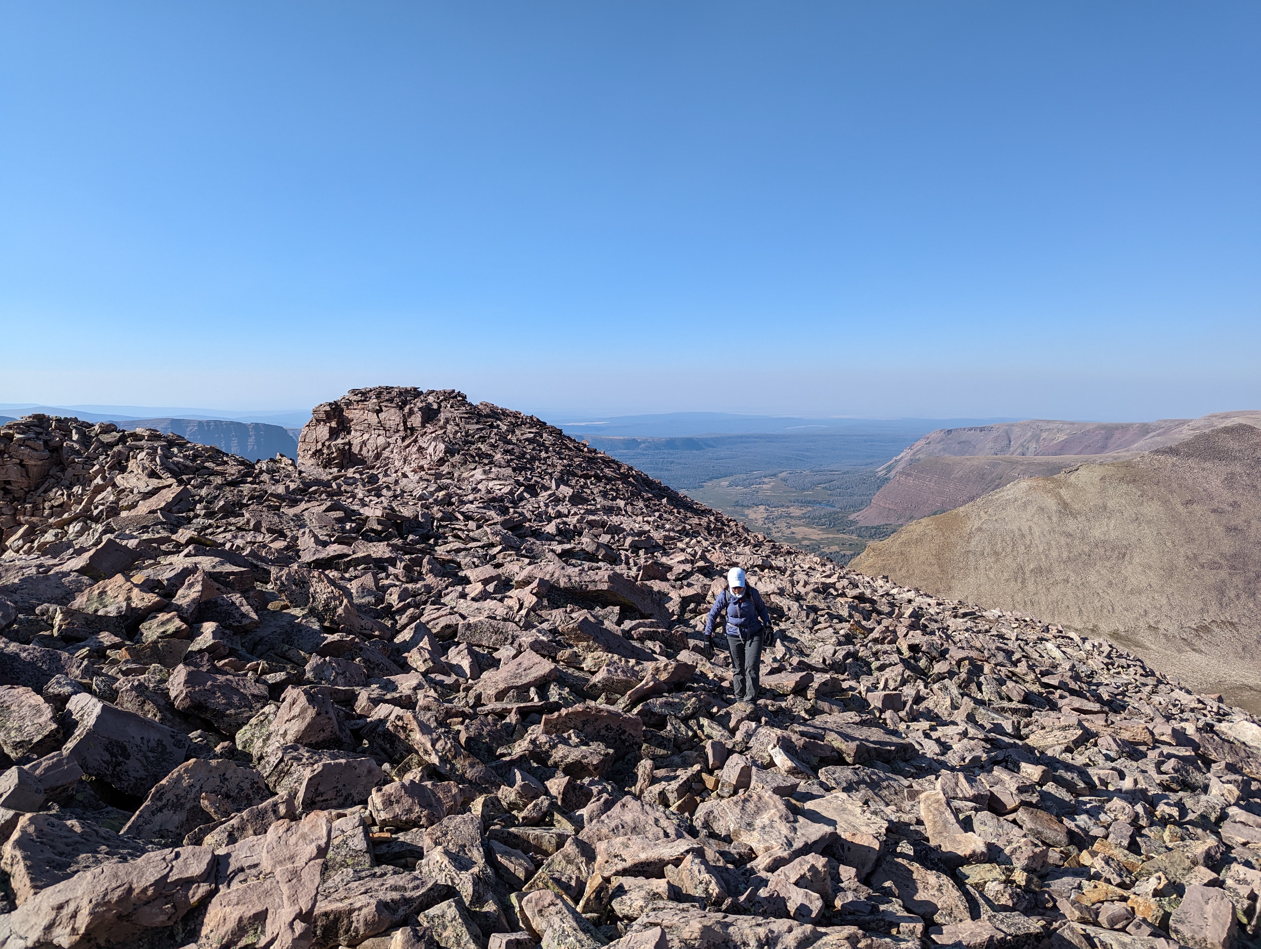
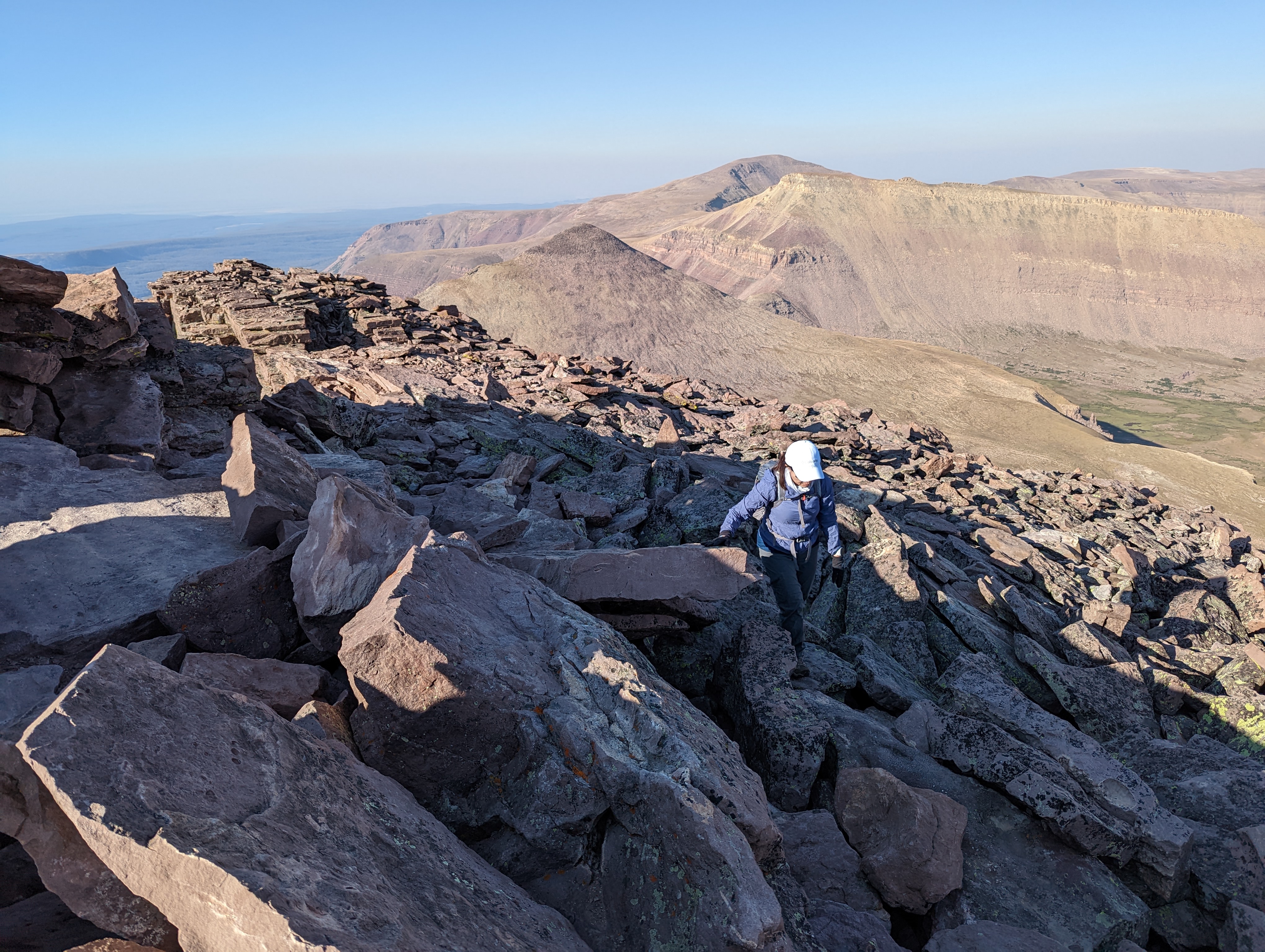
We weren't terribly fast, but without a pack full of gear we were at least a little faster than the previous afternoon hiking into our camp spot. We actually never saw the lakes we expected to see all the other campers around and seemed that the area was so vast that everyone scattered and pitched their tents all over the countryside. Still no one passing us going the same direction, everyone was on the way out. I was beginning to wonder how many people would be left to climb on to the summit with us on Sunday. Maybe they all started earlier than us and were just ahead of us? It's an out and back trail, so anyone in front of us we would pass on their way out. A common theme we were hearing from everyone that had summited a day earlier is the last 1,000 feet threw the rock piles were a son-of-a-bitch. I guess we had that to look forward to!
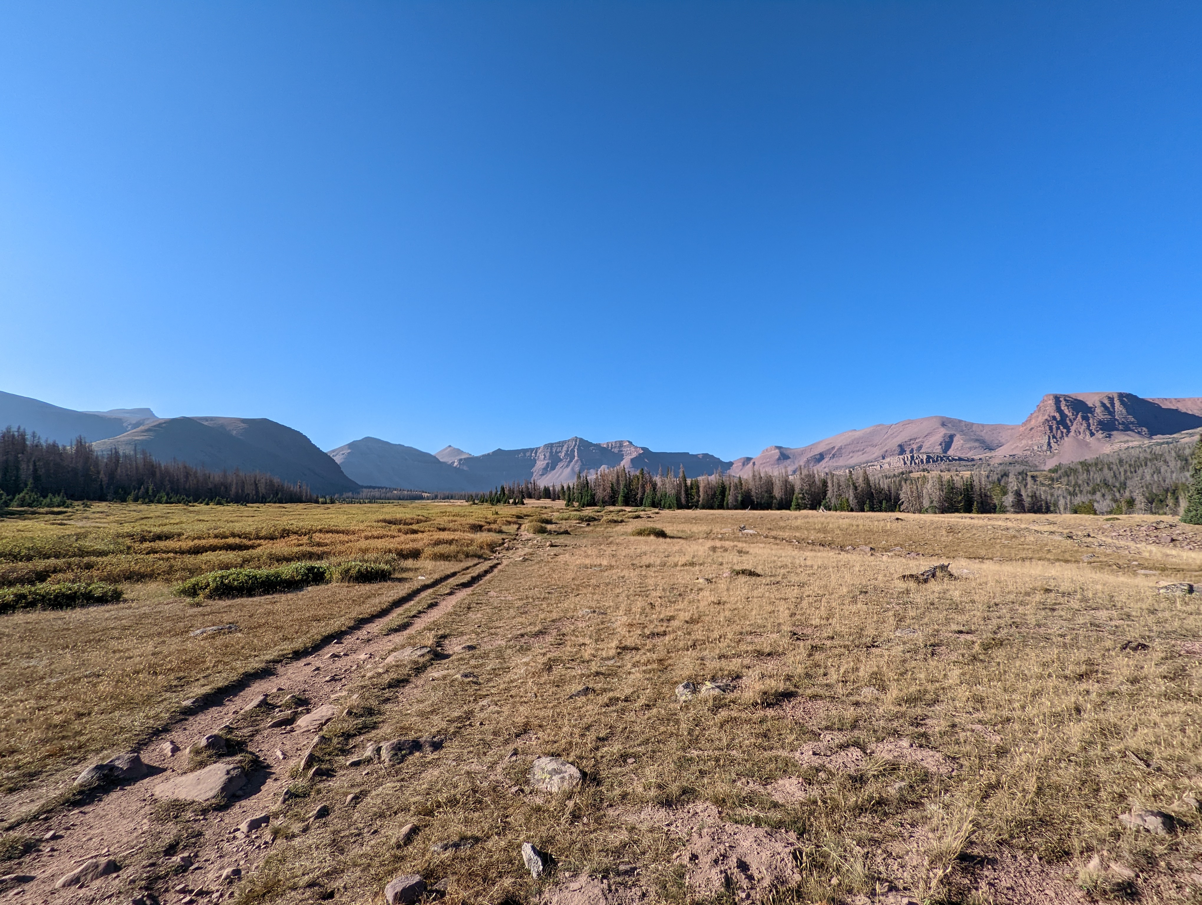
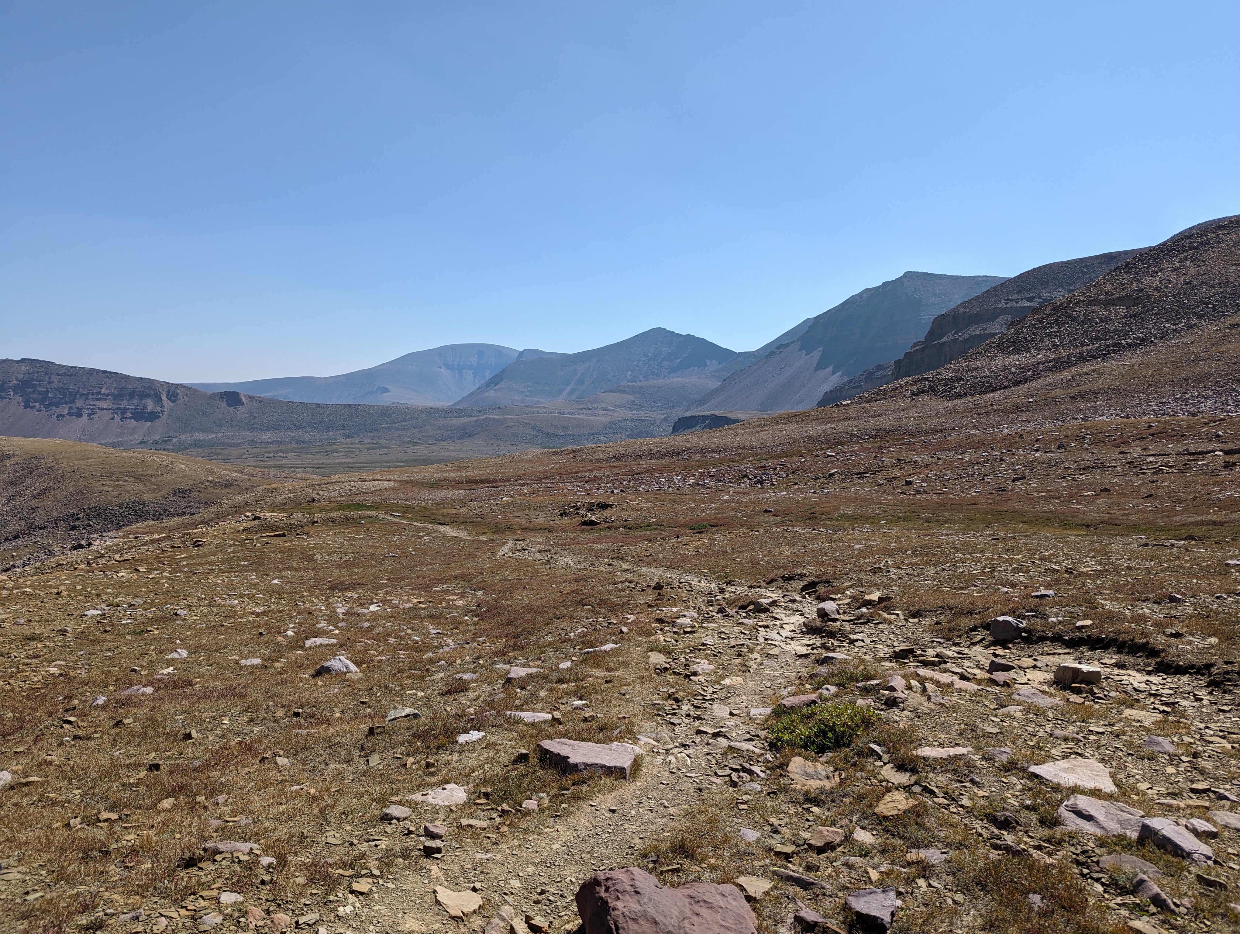
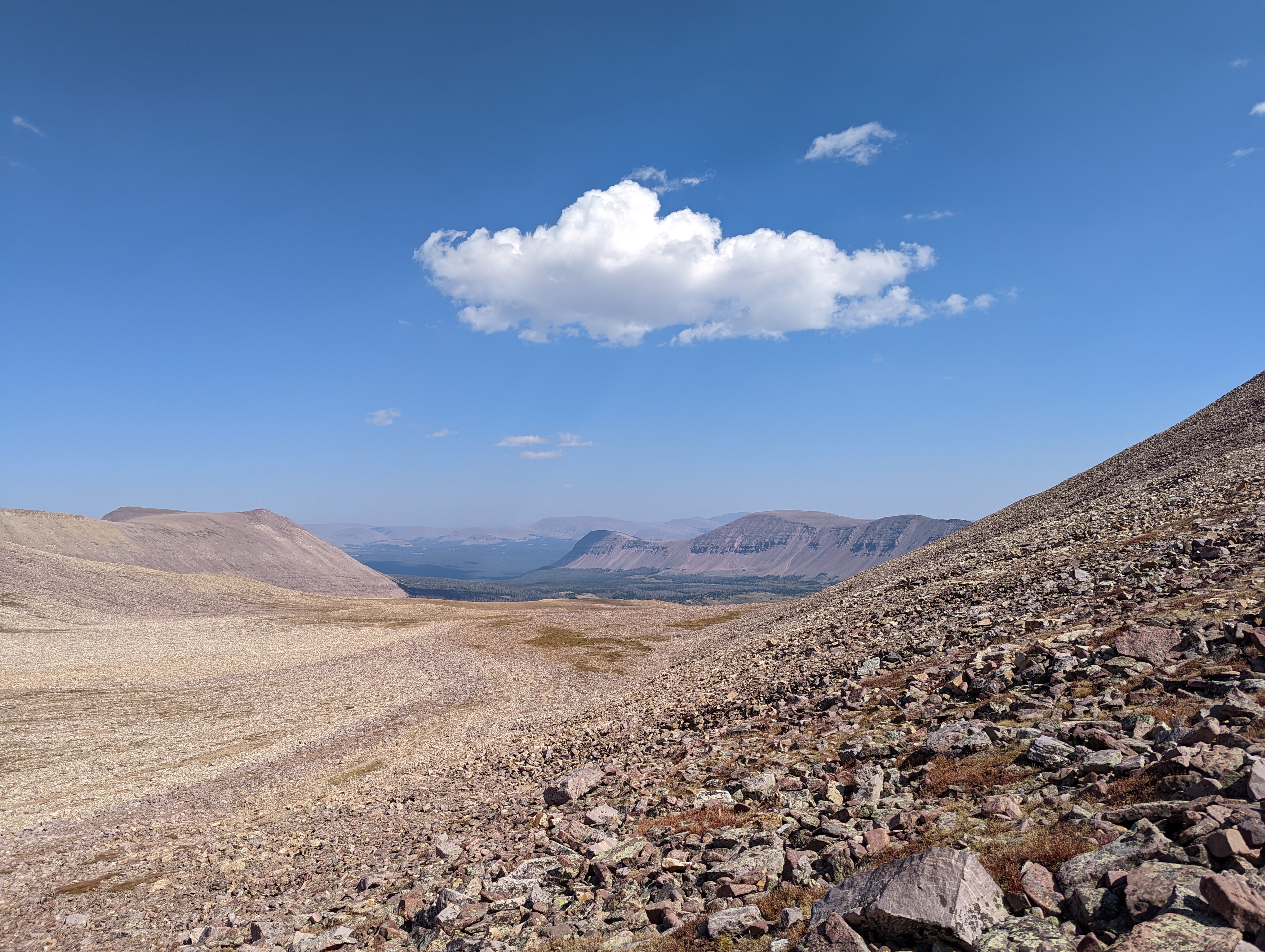
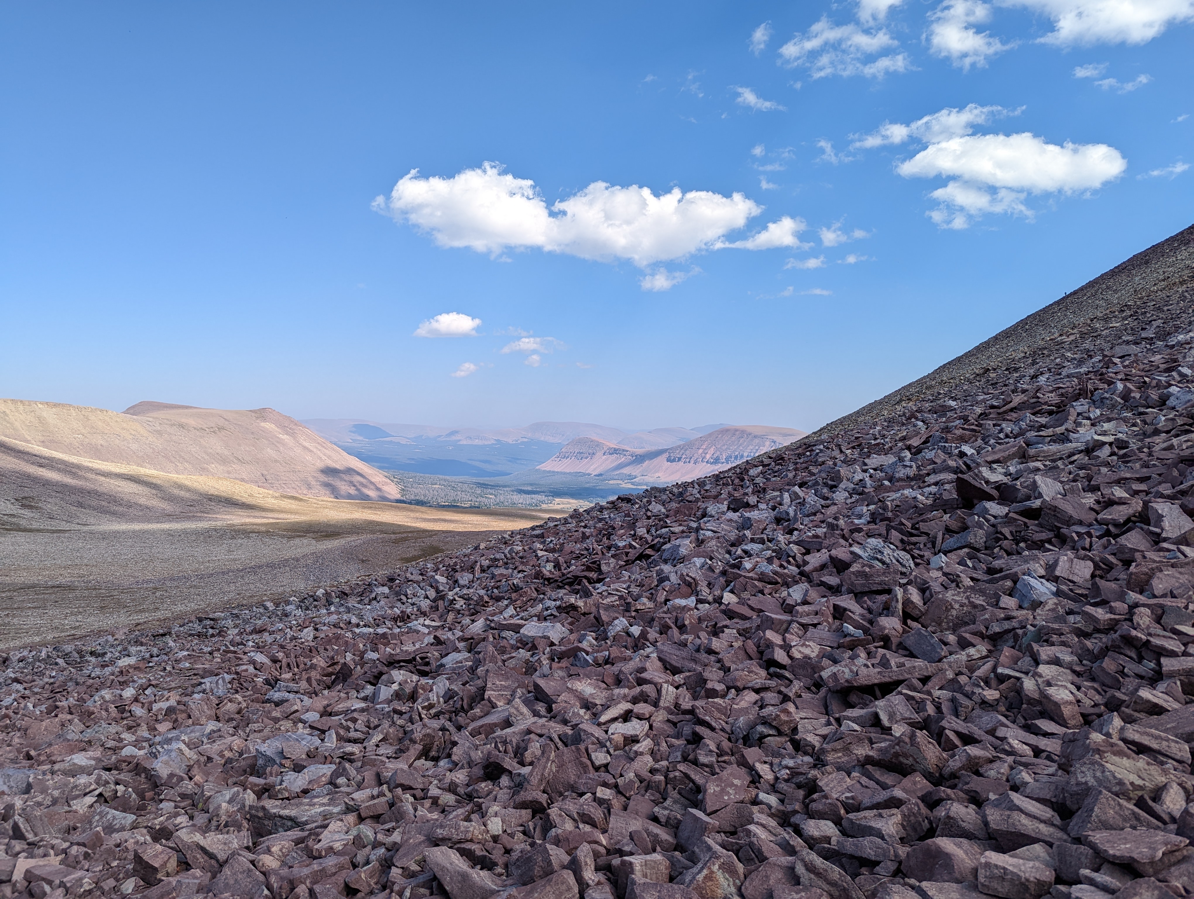
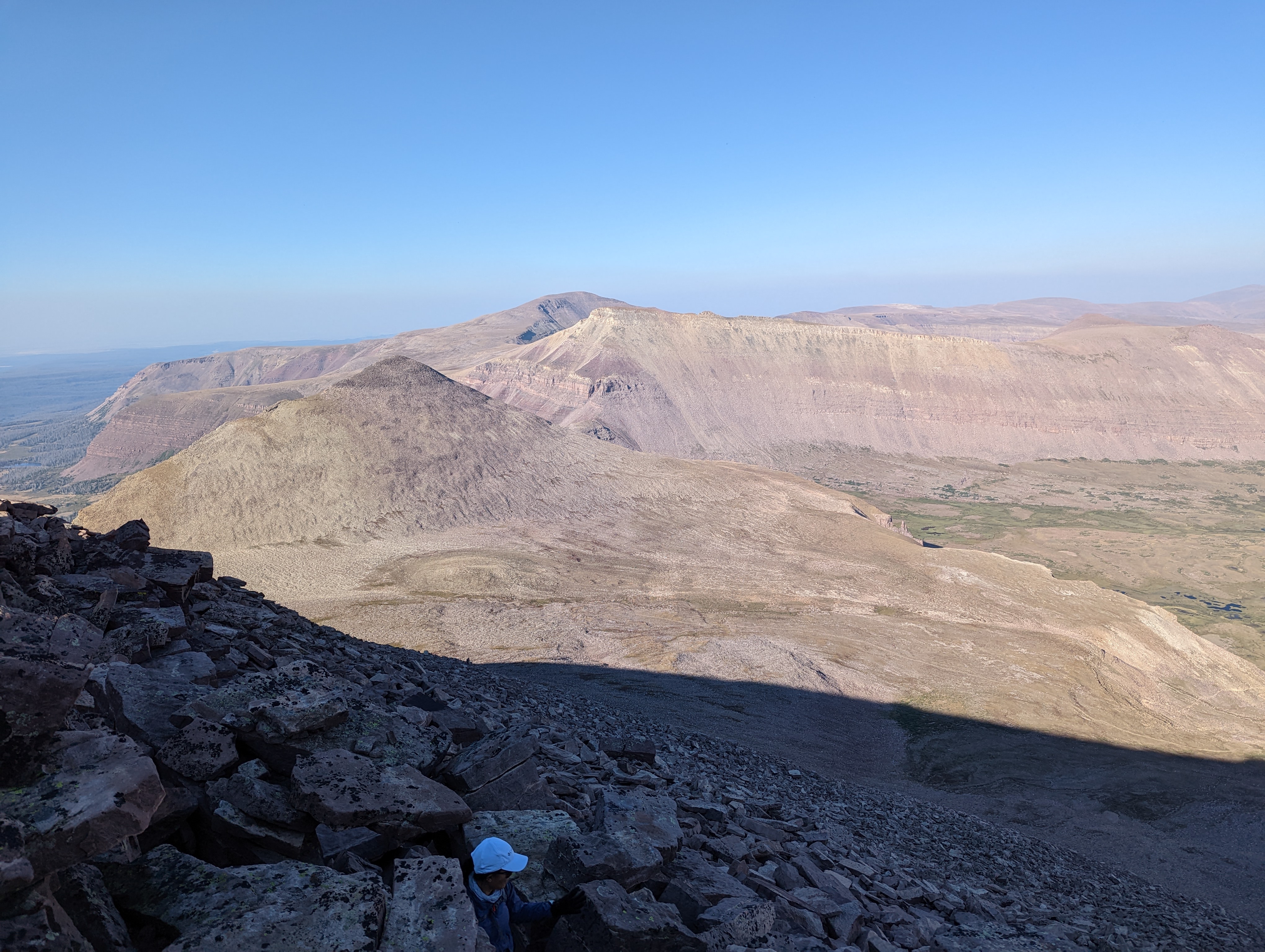
Off to the right (still far away) were great views of the mountain top (so we thought). Clearly, we could see Gunsight Pass which is where the trail really begins to climb. After all the research I did and all the pictures I looked at, it ends up I didn't actually know what mountain top was King's Peak. I was just following the trail and our map (with a little help from smart phone to know we were on track and where the next turns were) We now had left tree line and were surrounded by rocks the whole rest of the hike. The trail was pretty easy to follow. All the way up we only made one wrong turn but quickly realized we were going "down" instead of "up" so something must be wrong!
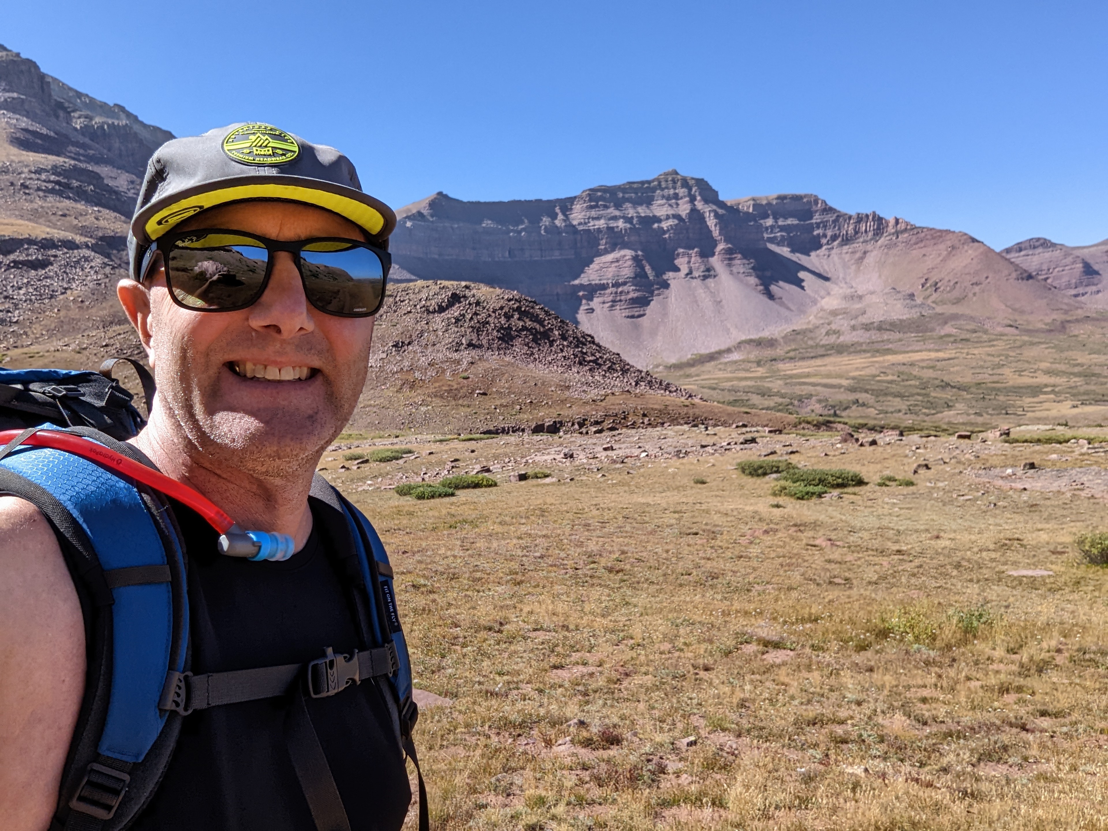
We got made the first obstacle of Gunsight Pass and then started our decent down the other side. We knew coming back up this at the end of the day would hard when we were more tired. From the top of Gunsight Pass was our first views of "the other side". The views were vast and there were lakes scattered across the flat lands. So beautiful. Here is where we passed our first solo hiker coming down from the summit. It wasn't that much farther to the rock pile but as the elevation got higher soon we realized this was the highest Mai had ever been. We did take Diamox starting a day day ealier which should help to prevent altitude sickness. So far no signs of any sickness, just each step got harder and harder.
We pass two more hikers coming down a steep section as we slowly trudged up it. While most of the hike was uphill, as far as we had gone the grade was not severe. There were about 3 sections that really slowed us down, but for the most part it was just a "walk in the park" only the park was as high as the clouds! The weather still remained beautiful. Even over 12,000 feet and approaching 13,000 feet all I had was a single layer sleeveless tech fabric tee shirt. A couple times I felt a little cold when we stopped for a break or snack, but as soon as we started moving I soon took off my light jacket I had pulled out of my pack.
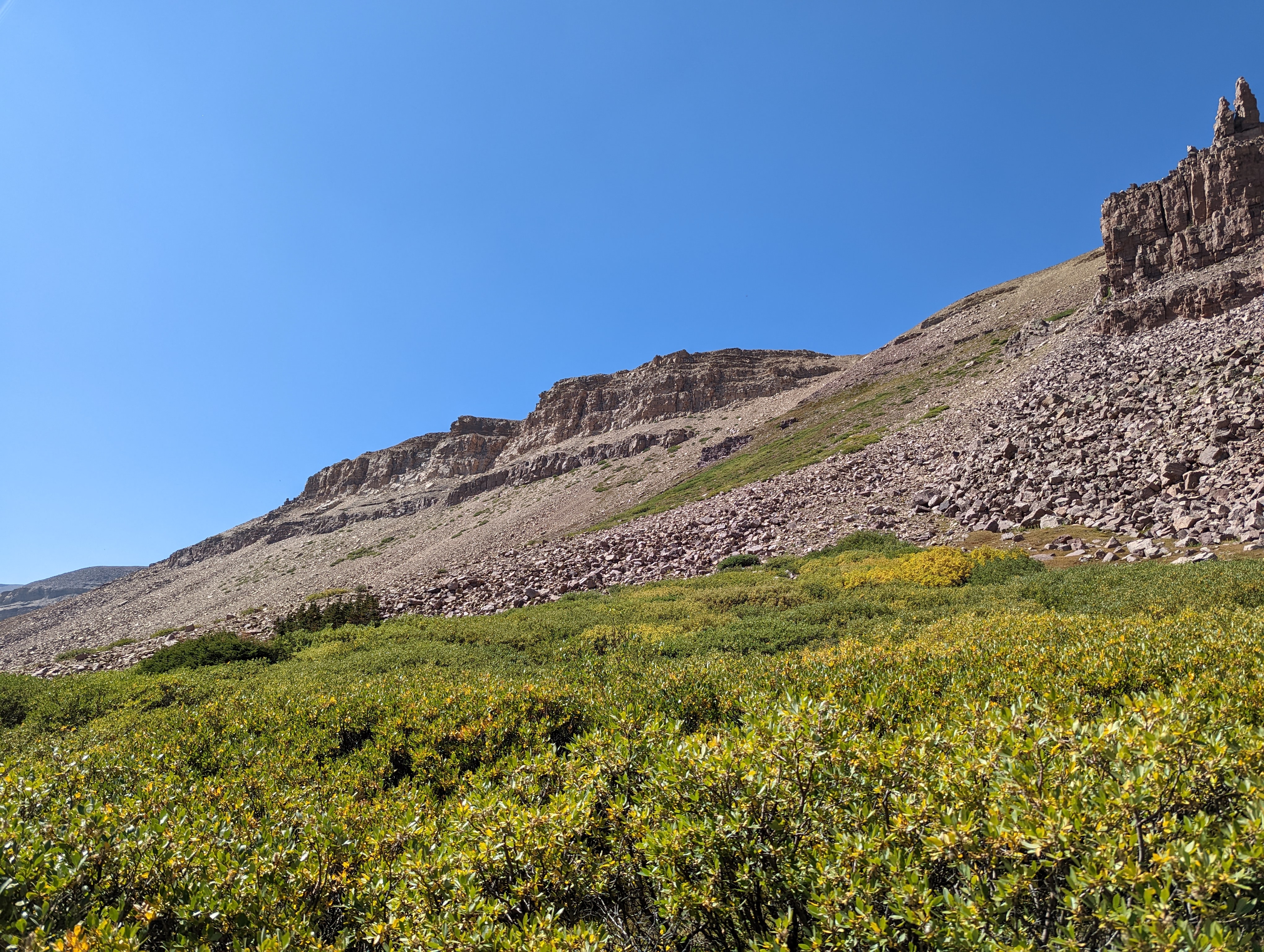
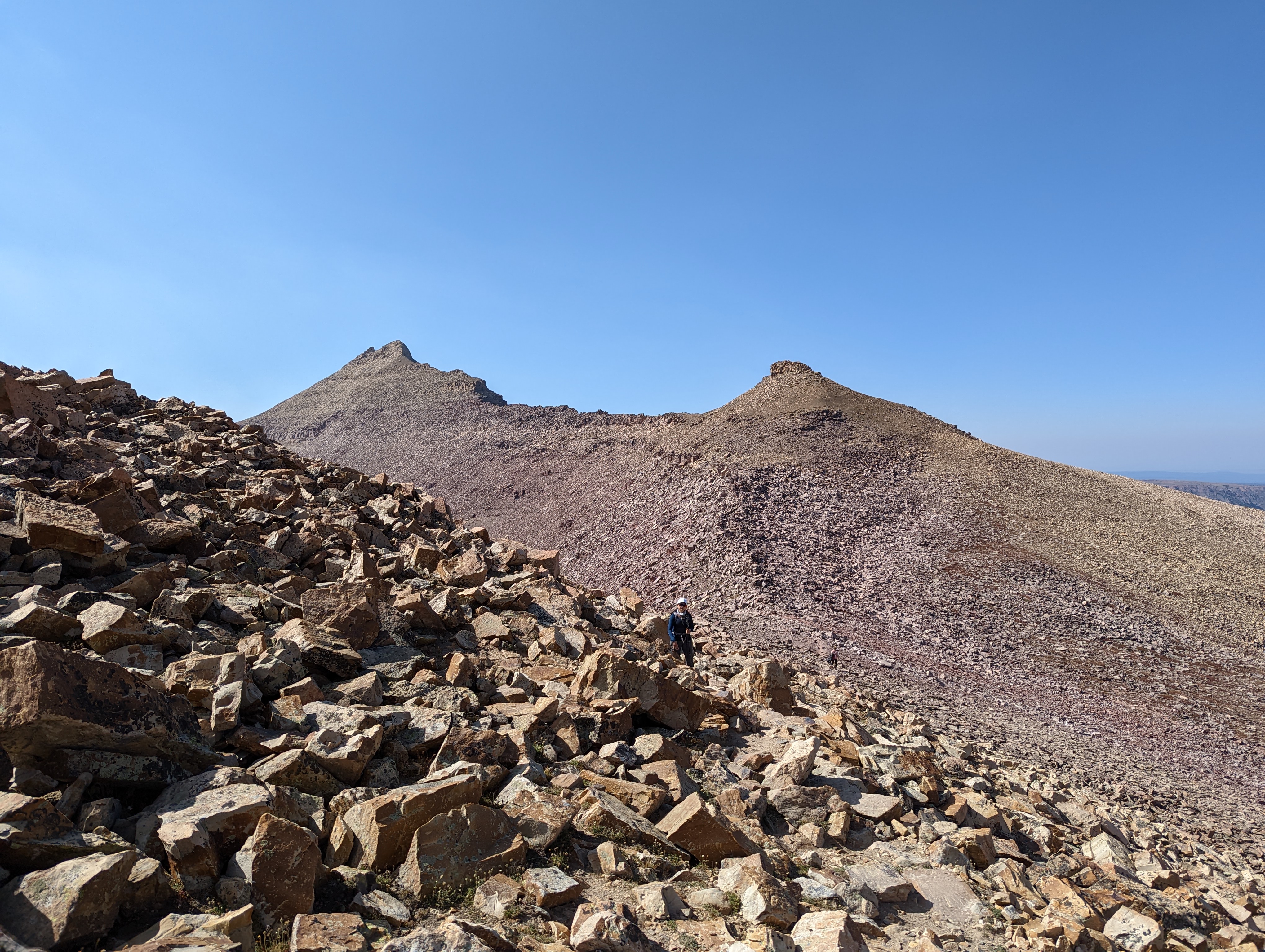
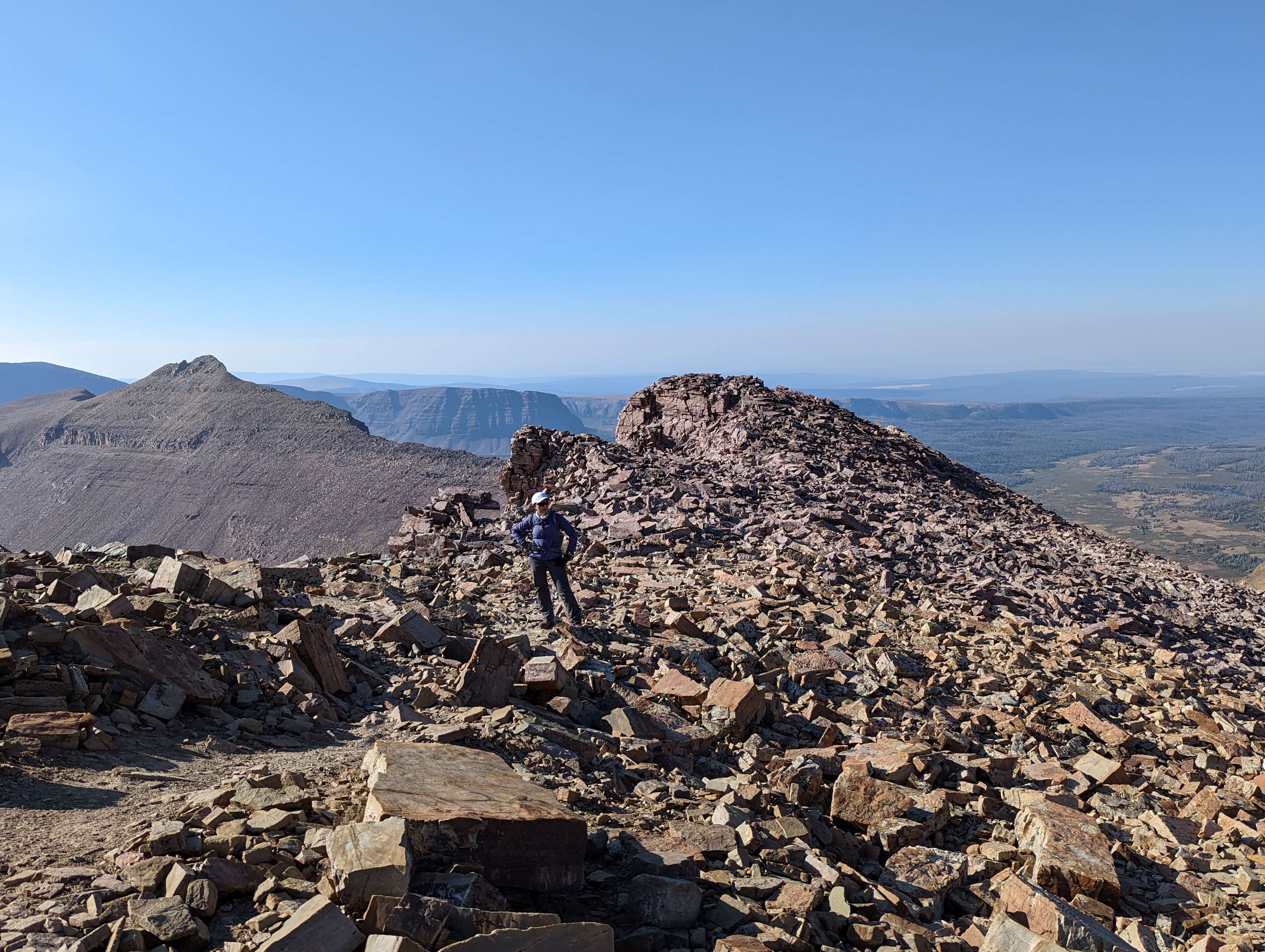
The last section before the rock pile was Anderson Pass. The trail was a little harder to follow and there were giant piles of rocks, not just small cairns like earlier on the trail. I suppose easier to see in the fog, rain, dark, etc. Looking at the map our peak was directly to our left. Looking up I didn't realize that the peak was different from where I thought I was heading all day long. It looked as if we could just start scrambling up anywhere and make it to the top, however, very steep. If you know anything about mountain climbing going straight up is always the shortest distance, but it's also the hardest. Much preferred is sticking to the trail, using any switchbacks, and hiking up the ridge which is a little less steep.
Most of the day we could look in both directions up and down and we could see no other hikers. It seemed most everyone hiked to the summit on Saturday. Finally, we had a view of the ridge to the summit and saw a couple hikers coming down. They were very spread out and scattered all over the rocks. We finally got to the rock pile and looked at our watches. We were still less than 13,000 feet and the summit was 13,528 so had nearly 1,000 more feet to climb. It was very steep so we would gain elevation fast, but crawling over piles of rocks was going to be slow. A closer look at our watches we were already at 7 hours for the day. If we were going to make the round trip in 12 hours that means we would have to get all the way up and down in the next 5 hours. We could barely get back to camp from where we were in 5 hours so right then I knew it was going to be a really long day/night.
Still Mai was in good spirits. We passed one girl coming down who like everyone else we passed said this is the section you've been "dying" for. Ugh. We opted to tie all our hiking poles to the back of my pack, put on our gloves, and start scrambling up the rocks. I was a little ahead of Mai so I could see a little better what was coming around the corner tho the worst of all is that we couldn't actually see the summit, rather there were 3 or 4 false summits. So as soon as you thought you were almost there you would see there was still a long way to go. We got to the top of the ridgeline a couple times and saw great views of yet another valley we haven't seen all day far below. The advice the girl we passed had was to stay just left of the actual ridge and keep going up. There was no more "trail" tho a few scattered cairns suggested we were on the right path.
An hour had passed in the rock pile and according to our elevation we had only made it half way through. Here's where we had to make our next decision. It's always good to have a "cut off" time where you need to turn around no matter what. We had already passed our 7 hour cut off time an hour ago but because of the great weather we were having I felt like we had a little leeway. Mai looked tired but was determined so we kept going. I didn't think we could make back down the rock pile in half the time as the way up, but I had hoped going down would at least a little bit faster. At this point I already had succumbed to the fact we would be hiking back in the dark. My biggest concern if we kept going up could we make it out of the rock pile before sundown?
At last we passed our final false summit and I really thought we were in the home stretch, yet it was still a long way away (and many more rocks to climb over). At this point the only reference point I had was to look at my watch and compare my current elevation to how far we had left to go. Once 1,000 feet to go was eventually 400 feet to go, followed by 200 feet to go and about this time I could about taste it. In the last two hours of climbing thru the rock pile my biggest dilemma was hydration. Because Mai's water bladder malfunctioned we were mostly sharing mine. Everything we had carried up was now empty except for one "reserve" 32oz Nalgene Mai had in her pack. I took it and claimed 16oz for myself and filled up my bladder and left the rest for her. I was already parched but did my best to take very small sips just to try to keep my mouth from being so dry. I knew as soon as we descended there was water we could filter just below on the slope up to Anderson pass.
At last I couldn't see any more mountain above, just a little cliff we had to find a good place to scale and I could make out a wooden sign on top of a pile of rocks. At last, could we finally be there? Oh my God, we were both ecstatic! We did it! Still the weather was super, hardly any breeze at all and we were not a bit cold. We paused for a few celebratory photos on the summit and while we didn't have a big appetite tried to eat a few bites of an energy bar and pretty much finish every drop of liquid I had. We didn't dawdle and quickly changed our focus and new we had to try to make some headway back down the side of this giant pile of rocks. \
We had left the summit 20 minutes ago and to our surprise we passed a solo hiker coming up. She wondered how much further, and we told her we had left 20 minutes ago so if she was going our speed then she had nearly that long herself to try make it. She kept going up and we continued to try to find a safe path back down. We quickly found that it wasn't much easier going down than it was to come up. Soon we noticed that the girl abandoned her summit bid and started following us down. She was faster than us and actually passed us. There were only a few cairns to follow in the rock pile and I ended up chasing down one that dropped us about 200 feet below the ridge, but there were no more cairns to follow. She hollered from above, I have a set of cairns up here. We acknowledged her observation but lacked the energy to try to climb back up to her and hoped the set of cairns we followed would lead us back to the same place.
Soon the other hiker, moving faster than us, disappeared as we were now on two separate paths. Mai thought we should just go straight down to where we could see the trail way below, however, I was assured the steepest and shortest path is still the hardest way and wanted to try to get back on the line that we climbed up. We slowly made our way down but not a bit faster than the way up. After an hour on the way down we were still above 13,000 ft. I could see the trail below and never saw the girl come out, so not exactly sure what happened to her. I thought she was ahead of us but she was higher up on the ridgeline so I just couldn't see where exactly she was.
A few more discussions with Mai on our trajectory. We chose not to climb the 200 feet back up to the ridge, but basically follow a new path 200 feet below the ridge all the way back around to near where we began to climb the rock pile. I kept referring to the app and comparing our location to the trail (i.e. the line we came up) to see how far off we were. Still not able to make it back up to the same line I saw a "shortcut" on the map. We soon recognized there was a bit of trail, not easy to follow, but we could pull our poles back out and instead of clutching every rock we climbed over we could actually hike slowly through the shortcut that resembled some sort of actual path someone else had been before.
At last, it was sunset, and we escaped safely the perils of the rock pile. Damn that was hard. All said and done it took exactly the same amount of time up as down, or 4 total hours in the rock pile. I had tried to suck every drip of fluid out of my water bladder for the past 2-3 hours and couldn't get to a sustainable water source quickly enough. I had a pocket of gummy bears that I kept snacking on to try to moisten my mouth.
I was so thirsty; I swore I could drink a whole 32 oz bottle in a single gulp. I knew there was one really good source of water we passed, but we didn't wait for fear of missing it in the now dark, so the first, well second, chance we had to filter we stopped, and I collected 4 liters of water for our return hike, still another 7 miles to go, now completely pitch-black outside. One bottle I filled with Gatorade powder, so we had some electrolytes.
As I was filtering water a big glow appeared in the sky. The moon had just stared to appear in the distance. There was smoke, not sure if it was blown in from out of state, but because of the polluted air the moon as it rose was completely orange like something I'd only seen one other time when there were fires and lots of smoke in Los Angeles. It was amazing! When we stopped it was the perfect opportunity to break out our headlamps for the first time. Fingers crossed they would last as we had to back track our earlier steps all the way back to our camp. As the moon rose higher in the sky it slowly became whiter and again lit up the countryside like the night before when we were in the tent. Especially beautiful was the moonlight reflecting off of all the scattered lakes in the flatland below.
Believe it or not in the darkness I made out almost everything we passed on the way up and knew that we were on the right track. We slowly dragged our tired and weary bodies back the way we came. We made one wrong turn in the darkness when we missed a switchback but once again broke out the app and could see our mistake and quickly got back on the trail. I looked back and saw a distant head lamp coming up the same trail from behind us and down from the summit. Did we actually get out of the rock pile before the girl that was solo hiking? Who else could it be? They would never catch us so we will never know.
Next was the part we had not been looking forward to which was climbing Gunsight Pass for the 2nd time. While it was a constant uphill, it was not terribly steep, so we were able to slowly make progress with very few rest stops. We kept on trying to figure out how far we had left to our tent and what time we could possibly make it there. The back down the front side of Gunsight pass was a piece of cake and the trail was easy to follow most all the way home. Of course, the moonlight helped, but also our headlamps were amazing and didn't falter.
Every time we stopped to take a break I would check my watch, try to figure out how far we had to go. Best guess is that we could make it back to our camp between 1 a.m. and 2 a.m. which made for a long day/night. We stayed focused and kept moving and started to get close to where we thought we had made our camp. Now it was starting to make sense, all the people that hiked past our tent in the middle of the night did exactly what we did and just got hung up in the rock pile too long and had to hike back in the dark. Knowing my tent reflect light very well I was sure we couldn't miss it. Mai was a little afraid we couldn't find it but I never had a doubt. Worst case we couldn't cross the river without crossing the bridge, and if we got to the bridge we had gone too far.
What we both forgot is that the night before we decided to make camp at 6 miles. We had talked about hiking another half of mile the night before, but when we found the site next to the river and it was the perfect spot we didn't continue that extra half of mile, so that meant tonight we had an extra half a mile to go. At last at 2 a.m. we stumbled back to our campsite, thourally exhausted. I promised to boil another bottle of water for Mai to cuddle with so while she climbed into her sleepingbag I fired up the JetBoil and gave her her wish!
We had little problems sleeping the 2nd night. There was no rush to get up in the a.m. and we slept in past morning light and waited until the direct sunlight actually hit the tent and started to warm things up. I think it was a little colder the first night, but we survived. Both nights not a lot of sleep. The first night was just hard to sleep and the 2nd night was just going to bed after 2 a.m.!
Once again, I woke up first, boiled some water for Mai's coffee and mixed things up a bit with a little oatmeal this time for breakfast. We slowly packed up camp and started our way back toward the trailhead. We passed very few people. I remember two solo hikers heading in and other than that we didn't see anyone else. We kept the same cadence as the first day hiking in taking a break every 1 mile. We were tired, slow and rundown, but made it back to the trailhead in about the time we expected. I suggested when we get close enough to the river we take our boots off and stick our feet in. I seemed to remember being closer to the water on the hike it, but didn't see a good place on the hike out until we reached the car. From the parking lot I could hear the stream just beyond some bushes so after the surprise of reaching the trailhead before we expected, we both took off our boots and dangled our feet in the cold river. Ah, it felt so good!
The trailhead was deserted. All the cars that were there Saturday afternoon were all gone. I think there were only 3 other cars besides ours. It was a little eerie to have the whole place to ourselves. I slowly pulled the rental car off the rocks I parked on a couple days earlier and seemed like the car was still in one piece. We made our way out the way we came. All we could think about is "real" food and where we wanted to go for dinner. There was one small town, population 200, we passed on the way in which had a grocery store so next stop was there for appetizers (and a clean bathroom!)


No comments:
Post a Comment