|
August 13, 2022
|
State Hwy-18 to Polique Canyon Road
|
|
Mile 266-278.5
|
5:05 (moving) / 6:42 (elapsed)
|
|
|
Max 8,184 feet (+2,357 / -1,651)
|


Pacific Crest Trail – Day 20
After a two month break at last I had an opportunity to get back to the Big Bear area to pick up on the PCT where we left off. It had been a hot two weeks in Los Angeles so escaping to 7,000 feet would bring a relief to the summer's heat. As I've become a little more lazy with the trip planning responsibilities, again a shout out to OoBrianoo for helping with scoping out the end destination for the day.
Our last hiked that ended at State Hwy-18 I had seen a couple signs for PCT taxis. They had come in handy at the very beginning of the PCT adventure a couple times. For fear the road might not be passable to the where the truck trail crosses the PCT, especially because believe it or not just two weeks ago flash floods plagued Big Bear so there was a chance the road might not be in good condition. If such the case having someone else that has a car that can handle back country trails might come in handy. Oobrianoo looked at Satellite imagery and determined it was only about a two mile drive on dirt & we should be able to get there.
So the plan was like last time, meet at McDonalds for breakfast at 8 a.m. and drop off one car at the end point and shuttle with our other car to the start. Mai's schedule is usually the hardest to coordinate so she usually is the deciding factor if we hike on Saturday or Sunday. In this case Saturday would be better for her which meant I had to switch my weekend dates with Parisa, no problem, her mom agreed. Very last minute Mai had determined that the stress of the week with work and lack of sleep she should sleep in and get some rest. That left me with a really tough decision of cancelling last minute on Oobrianoo or Mai missing out on our first PCT since we began this adventure nearly two years ago. I was eager to get one more day closer to finishing Section C so decided the show must go on and have this funny feeling I'll be back to do this section again together with her.
The day was only supposed to be 12.5 miles which is pretty light millage for an average PCT outing. I was really looking forward to the scenery of Big Bear and the hopes of great views of Big Bear Lake. I've never spent time north of Big Bear Lake so the territory we would be exploring would all be new. We have had nothing but sunshine, but only 1.5 hours away from Los Angeles the weather is completely different and Oobrianoo pointed out that we might have a little rain on the last part of our hike and that we should pack a rain coat.
Dropping the first car was mostly easy. A little confusion because the two different maps we used called the road we needed to travel two different names. Once again Oobrianoo's directions were full proof and we made it to the trailhead. Funny, we followed another Prius exactly like his so if one was going to get stuck it would get stuck before us. Ha. Most of all the other cars on this busy back road were all 4x4 so we did feel a little out of place with our low clearance vehicle. We found the trailhead and dropped off a gallon of water for other thru hikers and headed back out the road we came in to our familiar starting point at Hwy-18. The other Prius stopped the same trailhead parking and were hiking to a local summit, but I didn't catch the name.
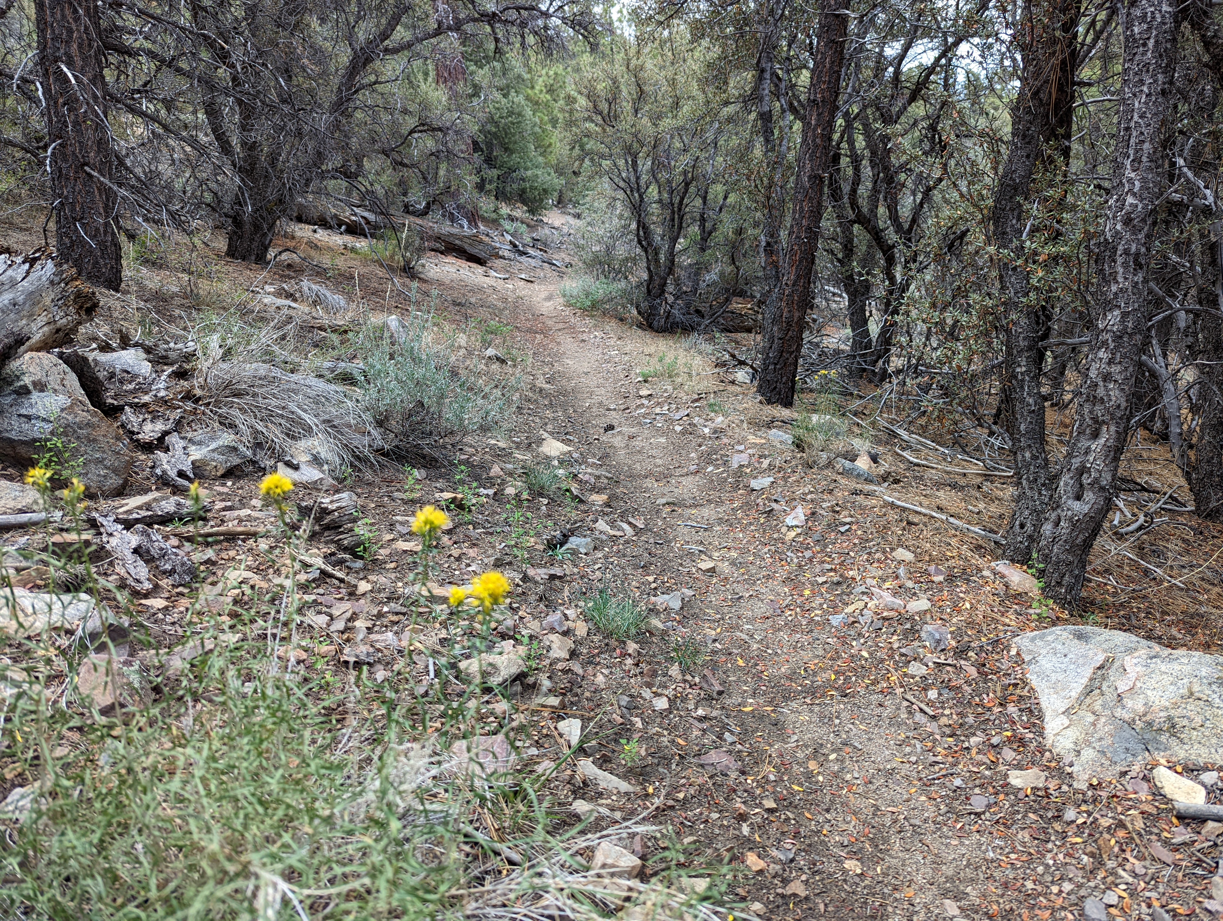
Juno hadn't been on the PCT for a while, so I was hoping he could survive the 12.5 miles the day was supposed to bring. I even got him a backpack and this time because of lack of water (none) made Juno carry two liters for his hydration on throughout the day. We expected 4-5 hours and by day end we were pretty close to this estimate. The day was a few rolling hills but more up than down this time with most of the "up" in the first few miles getting us from the road crossing back into the mountains. From the edge of the parking lot there are great views eastward of the desert, but it never crossed my mind the first mile or so of the day we would have more vast views of the desert below, which of course was nothing less than magnificent!
As usual, we play a little game of guessing how many people to expect on the trail. Last time at the same starting point the parking lot was packed but today only a couple cars. I guessed 2 people and a horse. Oobrianoo guessed 8 people. I might be way off on my guess because within the first half mile we passed two hikers with a big dog. At first I saw only the dog and got a little spooked that it was a mountain lion, but soon heard voices and saw it's owner. I don't think they were PCT hikers, just hiked from the road for a small hike. We pretty much didn't see anyone else the rest of the day until the very end, more on that later.
The morning was mostly uneventful. I noticed there were a lot of back forest roads intertwined along the PCT so there were constant trucks & dust below. We hiked through a boulder field of rocks and through a recently burnt section. Passed a old mining area visible in the distance. Doble Mine
Already I was getting hungry, but we pressed on with the half way point of 6 miles as our goal before we stopped for lunch. By the time we got to 6 miles we were both ready for a break and found a couple downed trees that made for perfect seats. The skies were already growing ominous and about the time we finished lunch it started to get darker and at first a sprinkle then a continual steady rain. It was nice middle 70's but the rain cooled us off and forced us to pull out the jacket already stowed in the pack.
We did have an actual dirt road trail crossing and were reminded again although it felt like we were in the middle of nowhere there were 4x4's on the nearby back forest roads. It pretty much rained on us for the next 2 hours or 4 miles and then started to sputter out and partly cloudy skies returned. When the rain came it cooled down and was very glad I had packed a windbreaker, however, it wasn't a waterproof jacket so I got a little wet. I also didn't back a second shirt so after I got wet it took a little longer to dry out. Ugh. I expected to higher on the ridgeline or at least on the south side of the ridge, but most of the hike we spent on the north side of the ridge with view to the north and other giant mining operations in the distance.
We saw a turn off to the left to Bertha Peak (8,201 ft) and looked on our far out app and it was only about 3/4 mile hike to the summit. There was a false summit you could see from the PCT up a steep ravine, however, at the top of the ravine the road turns left once again and pretty much follows the ridgeline all the way to the top. It was pretty much straight up. There was a couple that we passed on the steep section to the summit which were the only hikers we had seen since our start early in the morning and we didn't officially pass them on the PCT, so not sure if they count towards daily PCT hikers? Oobrianoo was hoping for a SOTA summit but after making to the top he didn't have his external antenna and wasn't able to get a signal to connect with anyone. The summit did offer great views of all the the Big Bear Lake basin area the view I had hoped for all day!
Pictures from Bertha Peak
We turned around and headed back down the steep trail and noticed Juno had started to limp a little so his paws took a beating on all the rocks all day. We made it back to the PCT and turned left again to make our way back to the car only about 1.5 miles away. What we didn't pay attention to was a sharp turn in the trail to stay on the PCT, so we ended up going straight and ended up off the PCT on a side trail that goes down to the lake to a visitor center. The trail we stumbled upon was along the ridge and headed right down toward the lake. Thanks to Oobrianoo he realized something didn't seem right and checked FarOut app and we had gone over 1/4 mile out of our way so we had to double back and figure out how we missed the PCT.
Sure enough as we had our eyes affixed on the great views of Big Bear Lake to the left there was a sign on the right with an arrow directing PCT hikers to make a sharp turn. Once we figured out where we made our mistake we took a picture of the missed sign and headed in the direction of his car we had only about a mile away. We finally passed a guy with his dog on the last section heading back to the car. I think he was just doing a short hike, but we actually did pass him on the actual PCT so he counted as our 3rd person (and 2nd dog) we saw for the day.
We made it back to his car and celebrated another great day on the PCT. Immediately we headed back to the starting trailhead to pick up my car. I forgot to pack an extra bag in his car so was ecstatic when he pulled out a package of Orero cookies to snack on the ride back. On the dirt road we passed a whole slew of 4x4's heading toward us. I think they all laughed to see our tiny little low clearance car on a road so far out of it's league!
We changed our clothes in the parking lot, said our goodbyes, and headed toward home. Hwy 38 which is the way we went home last time would have been an option again for the return trip, but flash floods from a week ago had left it shut down, so the option I choose to go home was actually driving around the north side of the lake. I'd never done that before and it was a very scenic drive through a couple small little villages I didn't even knew existed.


No comments:
Post a Comment