|
Oct 9, 2021
|
Saddle Junction to Fuller Ridge Trailhead
|
|
Mile 179.4-190.5
|
5:31 (moving) / 7:06 (total)
|
|
|
Max 9,073 feet (+2,688 / -2,892) plus another +1,680 on Devils Slide Trail to get to PCT
|


Pacific Crest Trail – Day 13
It's hard to believe five and a half months (or 167 days) had passed since we left the PCT on April 25th. On our last hike we had to navigate the infamous boulder blocking the trail on a cliff (which since has been blasted and trail cleared) and lost the trail trying to navigate thru snow fields. As soon as May rolled around so did the summer heat in the Palm desert. While our hike next hike would mostly be at higher elevations in the San Jacinto wilderness our biggest concern was for our safety and avoiding exposure to excessive heat.
It seemed as the best plan of attack for the last two days of Section B would to be hiking them on continuous days which further complicated trying to coordinate all three of our schedules. We started Section B with a new friend Oobrianoo and he didn't miss a beat and was there every step of the way. Having a additional person provided us more company including twice he had a friend of his join us. More importantly was the leap of support for logistics as each hike is always point to point and by having him along for the ride means we also have another vehicle at one end of each hike which saved Mai and I from each driving ourselves to each trailhead as well as driving two cars home late at night after all the long days on the trail.
In addition to the heat, one thing after another seemed to come up over the summer as we tried to coordinate all three of our schedules. First was a trip to the Grand Canyon May 30, followed by Oobrianoo taking his own trip there with his family, then a trip to Lake Tahoe the end of July, Oobrianoo son's soccer schedule as well as finding a whole weekend we were all available to hike. Finally the planets seems to line up and the weekend of October 8, 9, and 10th was our ticket to finish Section B.
We had all summer to plan and what made the most sense was to hike continuous the last two days in a row. The biggest unknown was getting to Fuller Ridge Trailhead. It was about a six mile truck trail and various reports gave different road conditions. In the spring it seems as if 4x4 would be needed, if not 4x4 at least a high clearance vehicle. I thought Oobrianoo could get his Honda Pilot down the road but I was a little more concerned with getting my low clearance VW Golf over the rugged terrain. I just assumed I would have to rent a SUV for the weekend when finally I reached a ranger who said she saw a Ford Festiva make it all the way up the road. This was comforting enough news that I we could take a chance that her report was accurate. It ends up Oobrianoo sold the Honda Pilot so he would have to navigate the road in his Toyota Prius.
Never had we had to take 3 cars, but again because of the crazy logistics of the PCT, it seemed as the most logical plan entailed leaving one car at the end of the hike in Palm Springs, taking both cars to Fuller Ridge Trailhead on Friday night and camping at the trailhead, then Saturday morning taking 1 of the cars to the start of the hike at Humber Park Trailhead. We could leave all our camp gear/food in one car at Fuller Ridge Trailhead and after a days hike we would have everything at our campsite. Finally the last day we would hike all the way down to Palm Springs where our third car was parked Friday night, drive back once again to Fuller Ridge Trailhead, then all of us would drive back to Humber Park to get the last car that spent one night at that trailhead Saturday night. This plan allowed for the fewest drives up and down the truck trail to to Fuller Ridge Trailhead as well as each of our three cars would get to navigate up and down one time.
We couldn't leave Los Angeles until after 5:30 on Friday so our plan would be fore Mai and I to meet in Riverside at Applebees for dinner, park her car at Snow Creek Trailhead at the bottom of the desert floor where the wind was pretty insane, and then meet OoBrianoo near the turn off to Black Mountain Truck Trail. I think we had hoped to make it to the meeting place by 9:00pm and we were not too far off by the time we got there. OoBrianoo arrived early and took care of our hiking and backcountry camping permits. Also we had learned even to have a stove we had to take an online course and pass a an exam of a few questions to receive a permit. Both OoBrianoo and I took the course and had permits good for a year.
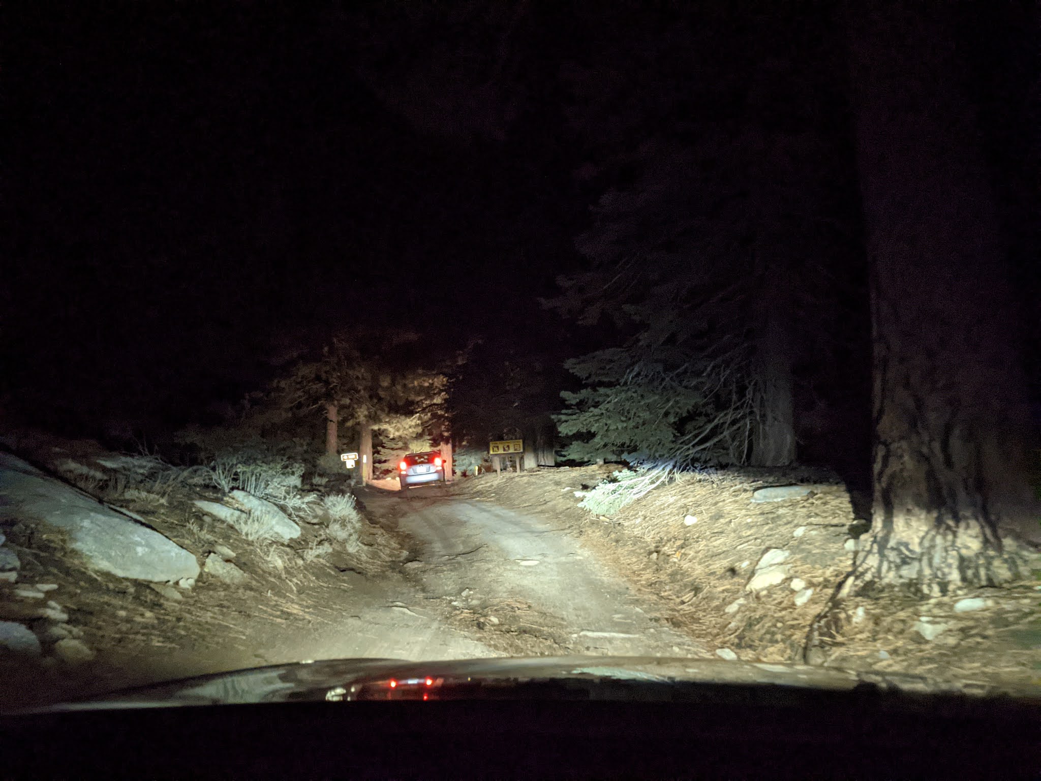
We followed each other up the truck trail slowly. A few sections were a little sketchy but at night you some of the perils of the road were probably hidden. We made it to the trailhead in about 45 minutes and arrived to a cool evening already with temperatures dipping into the high 30's and still pretty high winds which made things even cooler. There was one other car at the trailhead camping but they were already settled in for the night it seemed so it felt like we had the whole place to ourselves.
We found a large rock that blocked a lot of the wind which seemed the best place for our tents. Unpacking the car and getting the tent set up went lickety-split. Only one problem, when I tried to lock my car my key fob did not respond. After a little troubleshooting we figured out the battery in my key had died. Seeing that my car was going to be the one left overnight it was crucial we could lock everything inside and be able to start the car if needed. With no place nearby for spare battery we were fortunate that OoBrianoo had brought both of his keys and his remote had the same battery so we installed the battery from his remote and were back in business. Phew, disaster thwarted!
I think we finally were in bed by 11pm and slept till 7am so we all got a good nights sleep. We broke out the JetBoil in the morning and boiled some hot water for oatmeal and Mai had her coffee. OoBrianoo tricked me with some non-frosted Pop-Tarts. How is that even a thing? Eventually we loaded up our hiking gear for the day, piled into OoBiranoo's Prius and headed back down the truck trail we came up the night before in the dark. It the day time it was as treacherous on the way down as it was on the way up the night before. I jumped out of the car to take a couple photos of the view below which was spectacular as we were way above the clouds. I don't think we saved any time on the way back down the rugged trail as it took about the same time, 45 minutes, to navigate to the main road. By the time we finally got to the trailhead and started our hike it was already 10:15.
Yikes, both Saturday and Sunday were big days, each for their own reason. First Saturday we had gone back and forth many times whether or not we would be able to add San Jacinto Peak into our hike. Had Saturday been our only day of hiking the extra 6.4 miles to add to the day seemed reasonable, but the fact that Sunday was already going to be another 17 miles we needed to leave a little gas in the tank. Saturday's could be broken into 3 different parts. The first part was hiking back up Devils Slide Trail 2.5 miles and 1,600 feet of climbing just to get to the PCT. Then the PCT was 11 miles with another 2,700 ft of climbing. If we added San Jacinto it would add another 2,000 feet of climbing for a total of 6,435 ft for the day which made it even more tough.
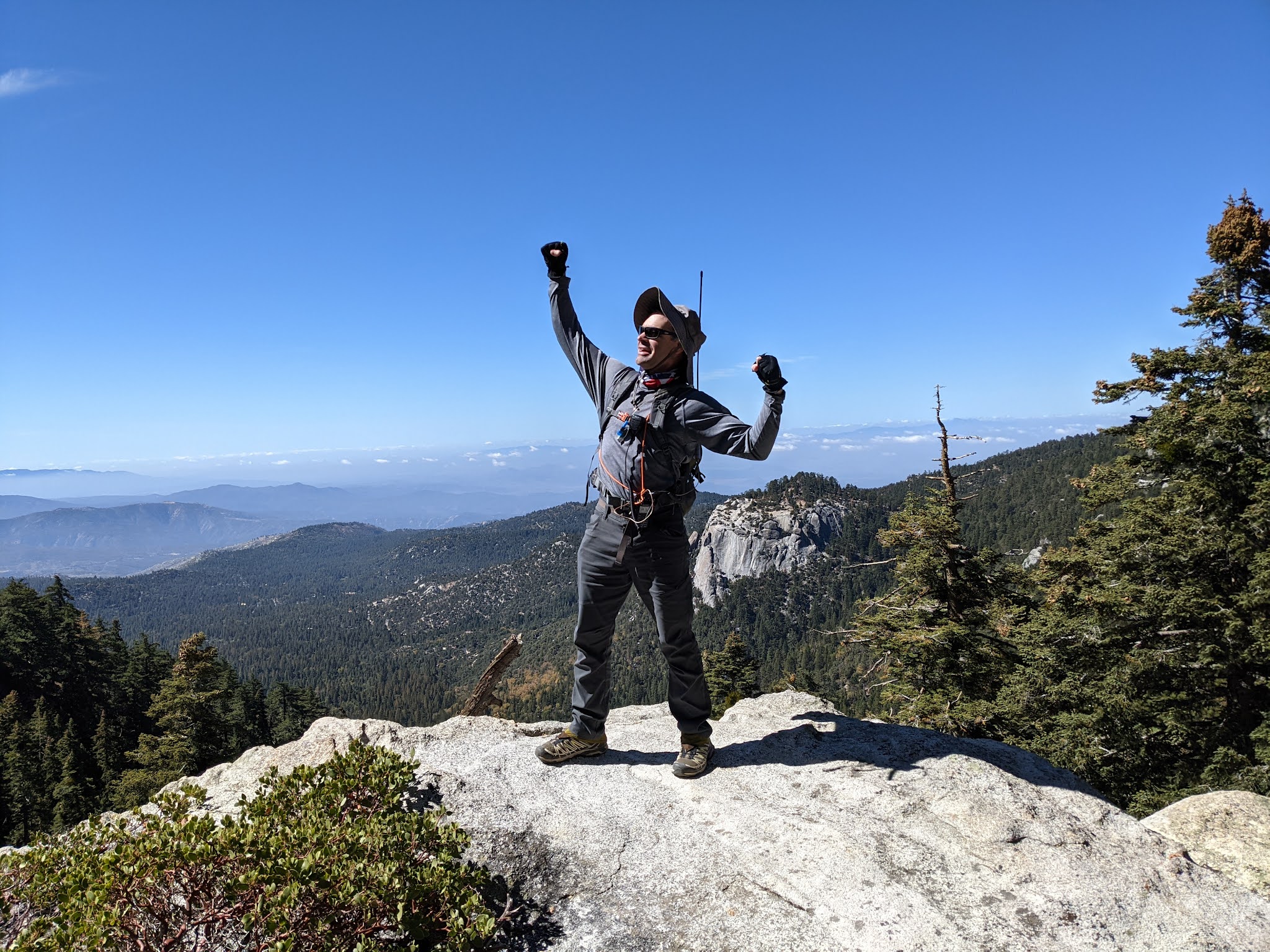
Starting out it was 1.5 hours of hiking just to get to the PCT up the 2.5 miles of Devils Slide Trail. Now just only 11 more miles to go to our awaiting camp site at Fuller Ridge Trailhead. As accustomed to all of our PCT sections we guess how many people we will see on the trail. We decided anyone on the connector trail didn't count. San Jacinto Wilderness is very popular area to hike so on a perfect fall day my guess was 15 hikers. I think by the end of the day I was right on the money. There was a nice rock outcropping we paused our from our steep hike up the PCT to take a photo.
Arriving at Saddle Junction as the name would suggest there were several trails so we analyzed all the signs and figured out which one was our path. We reminisced last time here it was nearly dusk and we parted ways with "Lost and Found" a thru hiker that we hiked most of the day together back in April when he decided to camp at Saddle Junction and we hiked back down Devils Slide Trail to our car. There have been different signs all along the PCT since the beginning of our journey. We noticed many of the markers in the San Jacinto Wilderness were wooden posts with the logo of the PCT branded into top section of the post.
The first 179.4 miles of the PCT was the first time I had ever seen any part of the trail, but twice I had been to Idyllwild for hikes. The first time was a failed 1 overnight backpack where we ran out of water and quite frankly with all the trail systems didn't really know where we were. The second time I had actually hiked to Jan Jacinto Peak on another hot day and suffered from dehydration. I knew I couldn't take this mountain wilderness for granted and needed to respect her greatness. The good news is that we studied the maps over and over combined with previous experience I felt like I had a better sense for our trail ahead for the day.
The first branch of the day was the shortest way to San Jacinto Peak, however, that was not our main objective so when we came to this junction. Rather we had to continue on the PCT and there would be a 2nd branch to San Jacinto Peak. The question leading up to our hike all week was whether or not we would attempt the out and back to the Peak. Mai was really excited to hike to the Peak again as she had such fond memories of her C2C hike a couple years ago. OoBrianoo had never been to the peak before and it counts for one of his "Soda" peaks so in a way I think he wanted to do it as well.
Our favorite views of the day were from the first fork in the trail to San Jacinto Peak all the way to Deer Springs Trail which had epic views off to our left on and off through breaks in the trees all afternoon. The October afternoons clock continued to tick away and our limited day light brought us to a decision point where we finally had to decide if we were going to do the Peak or not. Most of the day we were shielded from the wind but all the hikers we passed that came from the summit said it was extremely windy (and cold). We knew Saturday was shorter but it was also way harder than our hike planned for the following morning. We underestimated the round trip distance to the peak as the sign at the junction said another 3.2 miles (or 6.4 miles round trip). Doing some calculations in my head I knew that we wouldn't be able to make it to the campsite before 10pm, which meant at least 2 hours of hiking after sunset in the dark.
It was unanimous, we all agreed to forgo San Jacinto Peak this time around. Over the years I can recall many examples of good and bad decision with regard to hiking choices. While the trail all day had been very easy to follow as it's a very popular route and well traveled, the remaining section back to Fuller Ridge Trailhead must be the least traveled route. There were some rocky sections where we had to scramble as well as navigating the trail thru this area was difficult even in the daylight. I can't imagine having to find our way thru this section in the dark.
The last section of the trail again was very scenic as the sun was setting lit up the sky and was very beautiful. Still even without adding the Peak into our day, we ran out of daylight and the last 45 minutes or so we had to resort to turning on our headlights and hopefully not get lost trying to find our campsite. We referred to Guthook a couple times to make sure we were on track as well according to our GPS millage for the day we had to be getting close to our campsite. A couple of younger hikers coming down from the peak had a faster pace than us and quickly came from behind and disappeared ahead of us. At last we saw lights of their vehicles leaving the trailhead and as we were in the middle of nowhere we knew were close.
We were done with the first of two days in a row on the PCT. Already dark and again cooling off quickly after sunset Oobrianoo fired up his camp stove and I fired up my Jetboil and we made a delicious dinner. We still had some leftovers from Applebees the night before which made for a great appetizer while our dehydrated Thai chicken dinner was simmering inside the packet of boiling water. Everyone was ready soon after dinner to crawl into our sleeping bags to stay warm and get a good nights rest before our hike the next morning.


No comments:
Post a Comment