|
October 11, 2020
|
Lake Morena County Park to Desert View Picnic Site
|
|
Mile 20-42.6
|
9:42 (moving) / 11:45 (total)
|
|
|
Max 5,919 feet (+4,750 feet / -1,880)
|
Only two weeks had passed since Day 1 and I was ready to get back on the trail for Day 2. The date was settled on of September 27th tho one glaring problem this time around is that because of all the California wildfires the PCT was closed in all National Forests.
The second leg of my PCT hike goes right thru Cleveland National Forest so it appeared the trip would have to be delayed until the National Forest reopens. I found a number to the Cleveland National Forest Ranger District’s office and because of Covid-19 it’s not being manned, however, apparently, they are checking messages because I received a returned call. They are making new assessments every Thursday, and it was decided for the forest to remain closed.
Because of the forest closure my next weekend available to get out of town wouldn’t be until October 11th. Same deal two weeks later as the forest continued to be closed not because of any active fires but for fear of fire danger because of the dry and hot conditions. It ends up the 27th would have been another very hot day, but as luck with have it they would begin reopening on Friday Oct 9th and thankfully the forecast was for cooler weather.
I’m quickly learning that point to point hikes, especially far from home, are a logistical nightmare. For Day 1 we lucked out and found a ride from the campground at the end of the hike at mile 20 to mile 0. With limited day light in October for a 22.6 mile hike, we would have to start at sunrise and pretty much hike all daylight hours. I didn’t want to run the risk of driving one car again and having to rely on anyone else for early morning transportation the day of the hike so both Mai and I would have to drive separate vehicles.
To remedy two of the mistakes from Day 1, headlights were packed in case we ran out of daylight and I had my hand held Garmin GPS properly loaded with a base map as well loaded the PCT's track data. This would be a bit of a pain to load the track data because the technology of my old GPS only allowed 500 waypoints and the 22.6 miles had over 3,000 waypoints. I had to carefully dissect the file into smaller segments of 500 and upload each of them separately, but they appeared to work. I didn’t want to rely on a cell phone for fear of coverage but found a great free app called Gaila GPS which I can load all the waypoints in a single upload. It’s a great backup and easier to use than the Garmin. I don’t use an iPhone but it appears that this would be a great app as well as the online version has great features: https://naturalatlas.com/picnic-areas/desert-view-1897615
Day 1 Lake Morena County Park was the perfect place to stage camp just as it will be for Day 2. With two cars this time, the plan was for Mai and I to follow each other and dropped off her car at a park at then end of the hike. We basically drove the exact same route as last time and got a little earlier start so this time we were able to enjoy the view of the mountains along I-8 leaving San Diego heading east. The road up to Mt. Laguna is called Sunrise Highway. I-8 is probably about 3,000 feet and Sunrise Highway climbs all the way up to 6,000 feet. It’s a beautiful road and by the time we started up it was already about sunset. We stopped twice for photos and easily found Desert View Picnic Site where we would live Mai’s car. Getting out of the car at 6pm it was cold and windy, the temperature felt like had already started to dip into the 40’s.
We loaded up all her gear into my car and headed back down the road we just drove up down to Lake Morena County Park. Having been there only a month earlier, we already knew our way around so it was easy to find and upon arriving we knew right where to go to find the ranger station, our campsite, and the showers/bathrooms. We got a day pass parking permit from the ranger so we wouldn’t have to wait in line in the morning.
Mai had a big family tent so I brought an extra two person tent for her. I’d set both of the tents up many times so even tho it was already dark we had them both up in a flash. Only 8pm, but pitch black, I was ready for bed because the next day any extra rest I could get the better. There is very little light pollution so without all the smoke from the fires like a month earlier, this time around we could see clearly as the stars lit up the night’s sky including a bright orange Mars as this month was a once in a lifetime view of the planet.
The alarm was set for 5:30 and goal was to be on the trail at sunset. It took a little longer to pack up than planned so we didn’t hit the trail until 7:15, already 20 minutes later start than a month ago for our 20 miles hike and this time we were going 22.6 miles and the day was going to be much shorter, but no fear as we both packed headlights just in case they would be needed at the end of the day.
Unlike Day 1 which had no where to get water, this time the six mile mark passes right thru Boulder Oaks Campground. I had planned on going with 6 liters again like Day 1, however, 3 liters I would wait to fill up at mile 6. Mai was leery of water along the trail and afraid she wouldn’t like the taste so she decided to pack all her water from the start. I started with two 32oz Gatorades and one 32oz Nalgene bottle plus a Mountain Dew and a 20oz spare at the bottom of my pack for backup.
We easily found the trail connector from the campground to the PCT and hiked directly thru the red/pink fire retardant that was still there from a month ago. Once on the PCT we started our GPS and were off. It’ funny the trail circles back to the campground so if I wasn’t a purest, we could have started at the campground and saved a few steps as well as a few precious minutes. We hiked around the perimeter of the campground and the obvious path took us into this big beautiful open meadow, but mysteriously we hadn’t seen a single PCT trail marker. After two miles into the meadow I thought why not take a look at the Garmin GPS to compare our location to the track data that I uploaded and to my dismay, we were already off track.
We had hike two miles on the wrong trail. Apparently at the beginning of the meadow there was a fork in the path and we should have gone right. We had three options. We could bushwhack directly toward the trail, we could back track or we could continue on the path we were already on. Bushwhacking run the risk of the vegetation being too thick, backtracking would give us 4 miles of extra hiking on an already long day of 22.6 miles so thankfully having the base map data in the GPS properly loaded I could see that we could continue straight on our current path and it should run into a forest road which if we hang a right should take us back to the trail.
As luck would have it my navigating proved me correct. I expected that we were going to hike 1 mile out of the way but when we eventually found the trail again we were exactly 4 miles on our path and had we been on the PCT from the start we should have also been at 4 miles so our little detour didn’t add any extra miles to our day. It was a little tricky to find the trail at the 4 mile mark, but we saw a sign in between the bush that looked like where we were supposed to be. We were correct and the sign was a relief that we were back on the PCT.
Day 1 over 20 miles we saw 1 person. We joked about how many people we would see Day 2. Our first sighting was a small group of 4 hikers at about mile 5, they must have started from the campground a mile up the trail. They confirmed we were heading in the right direction and almost to the campground. The first 6 miles were pretty much flat so other than being temporarily lost, we were ahead of schedule and hiking faster than 30 minutes per mile.
At 6 miles we arrived at the campground and found it the perfect spot with a picnic table for our first real break of the day. I fired down a peanut butter and jelly sandwich, filled up all my water bottles, used the restroom and we were off a short time later.
After crossing under a bridge of I-8 we would begin our ascent at about mile 7. The climb would be over the next 15 miles up from about 3,000 feet to Mt. Laguna at 6,000 feet. This was the part of the trail there was no turning back and again it’s complete wilderness until we arrive where we parked the 2nd car the night before. We ran into the 2nd group of hikers, two ladies probably around mile 13. Also it was starting to heat up, after 5 miles into the hike the rest of the day was warm with temparatures in high 80’s & low 90’s until nearly 10 hours into the day. Around mile 20 when both the day started to draw in and because of the higher elevation it would cool down a little into the high 70’s.
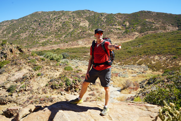
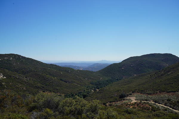
One of the great things so far of the PCT is that every corner you turn the scenery is new and although this was a long day, with the drastic change in altitude the landscape didn’t disappoint and continued to change. About 15 miles in to the day we were already to about 5,000 feet and while the air didn’t seem thin we were both beginning to wear down, but we tried to take break only every 1.5-2 miles instead of every mile.
At mile 19.5 there was a hokey right hand turn on the trail which the way the rocks were laid out didn’t make it quite obvious there was a turn there so we continued straight. The trail seemed to change, there were two tire track trails as opposed to a single track so it obviously seemed wrong. Again a quick check of the GPS and we realized we were off track. This time only a quarter mile out of the way with no significant elevation gain/loss. Soon we were back on track and the turn we missed seemed a little more obvious in that rocks were laid out forming a big arrow. We saw the first time but misinterpreted it’s meaning.
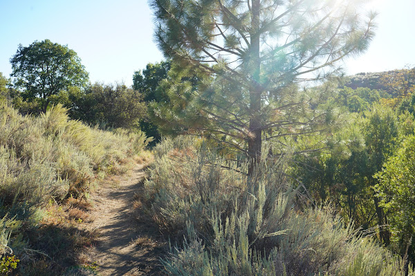
All day long I was thinking that 21.5 miles was the end point of the day’s hike but had a math error which the actual distance was 22.6, so that last mile seemed to take forever. We knew we were getting close to Mt. Laguna when we started to see pine trees next to us that we saw all day way off in the distance ahead up the mountain. Arriving in the Laguna Mountain the trail again was much different than the previous parts of the trail all day. There was even a 2nd trail called The Laguna View Nature Trail that merged with the PCT and the two trails became one.
The sun was setting fast and it would soon be dark. Mai’s rookie mistake was getting her headlight out too early and putting it on her hat and then still warm decided to take her hat off to cool down and flipped her light right off her head without noticing. Once it got dark we had to share my light, however, the last section of the trail was pretty rocky so it was hard for one light to work for two people.
Complete darkness set in the last mile of the day. Thankfully we both marked the cars location with GPS so starting about 2-3 miles out we kept on checking our progress to see how close we were actually getting. Especially in the darkness it would have been really easy to miss the turn off for the trail that lead to the car, so again the GPS was a life saver or we could have easily hiked on further missing our turn. Arriving at the car it was not nearly as cold as the night before and we were both excited to have survived Day 2.
The conversation then turned to what was more important a dinner or shower. Dinner seemed to get the vote but there were only a couple places that are normally open in the Mount Laguna area and they were all closed. Even fast food would have hit the spot but between Mt. Laguna and the campground there was nothing so we settled on the fact we would probably have get cleaned up and find something further up the road on the drive home. The only place that the Google Maps kept pulling up that was still open was a “The Malt Shop”. What we didn’t realize is that The Malt Shop was right in the little village of Lake Morena and we pulled in 5 minutes before closing. I would read later that The Malt Shop is a favorite amongst hikers. Partly because there are no other choices and partly is what they serve is exactly what you crave after a long day on the trail.
Nothing would hit the spot better than a cheeseburger and fries with a large Red Bull. We placed our orders and headed back to the Lake Morena Campground a mile down the road to retrieve my car and I multi-tasked firing down my burger and fries while taking a shower. I might add that after 11:45 minutes on the trail in the heat again from sunrise till after sunset and 4,000 feet elevation gain that may have been one of the best burgers in my life.


No comments:
Post a Comment