2nd Highest State High Point
8th Most Difficult
summitpost.org
wikipedia.org

 |
| Mount Whitney (14,494), California - State Highpoint #23 |
Ever since the crazy idea of visiting the high point of every state and especially after knocking off Mt. Elbert in Colorado and Mt. Rainier in Washington I’ve had a burning desire to climb Mt. Whitney and add not just another state, but 14’er as well to my list of accomplishments.
As destiny would have it, moving to Southern California the
end of 2007 would set things in motion.
With qualifying for Kona in 2008 adding Whitney to my plans were out of
the question the first full year residing in California, but in 2009 it was the
only thing in my sights for the summer.
Planning to hike Whitney is something that takes nearly a whole year to
plan.
First is getting a permit, because of the high demand you
must have an itinerary well in advance, in this case February a reservation
request must be made. You must choose
up to 6 dates in order of preference. I
inquired with a few friends who I thought may be interested and recruited a
friend, Greg Bachman, from Ohio who we once ran Pikes Peak Marathon together in
2001. Ironically we both summited Mt.
Elbert a few days before Pikes Peak independently of each other. Also my good friend Brian Schott, one of
our first friends in California was up for the challenge. Lastly, I learned our youth pastor at a
church we attend was a marathon runner so also invited him for the
festivities. Greg preferred to climb
on a weekday to hopefully have less traffic on the trail and it’s recommended
to climb under a full moon in case you end up on the mountain at night it’s
easier to navigate.
Greg and his wife Maureen visited us in California in
February. They actually spent a night in
Lone Pine a few days before arriving in Los Angeles and got a sneak peak of the
road that leads to the trailhead, but were turned around because of heavy
snow. We hiked in the San Gabrielle’s a
short hike so they could see my play ground a few miles from our home and we
could gauge our fitness and what we all needed to do before September. Greg provided me with a copy of the climbing
guide of Mt. Whitney which has plenty of good information of the trails and
history of the mountain.
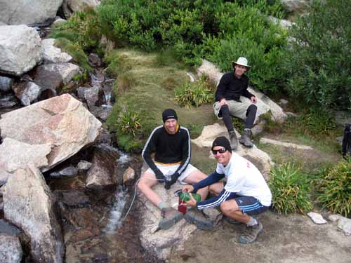
Brian Schott shared with his friend Ing of our plans and
also recruited her to join us.
Throughout the summer Brian, Ing and I enjoyed several climbs of Mt.
Baldy preparing for our adventure to Mt. Whitney. Our first climb took us to the Sierra Hut on
the Mt. Baldy trail. Another adventure
took us to Chantry Flats and the back side of Mt. Baldy. Brian’s friend Ing got involved with a
“meet-up” group and spent many weekends preparing on her own. She probably was in the best shape of all of
us. Brian and Ing learned of a seminar
at REI on climbing Mt. Whitney, so we attended to gain any information that
could help us.
I met Matt Glassier through work at Canon and learned he
climbed Whitney over a couple days in 2008 and had planned to go again this
time in 1 day in August. Matt and I were
able to climb once together to the 10,068 ft summit of Mt. Baldy. We went up past the Sierra Hut and took the
Devil’s backbone to the ski lifts and returned to the parking lot via the
lift. I felt like I was in superior
shape to Matt and was comfortable with my training when I learned Matt made his
successful 1 day ascent of Mt. Whitney.
My brother-in-law invited me on a Colorado cycling trip for
5 days of cycling the Rocky Mountains.
What better way to prepare for Mt. Whitney than spending a week at
elevation only 2 weeks before our climb.
I immediately accepted John’s invitation to ride. John and I are always challenging one
another so most of my summer I actually spent in the saddle training for
Colorado. Our 5 days of cycling
climaxed with a 32 mile ascent of Mt. Evans, the highest road in America.
During the Colorado excursion I for the first time tried the
drug Diamox which is used to treat elevation sickness. Ends up taking 250mg 2x per day starting 3
days before traveling to elevation limits the body’s negative reactions to high
elevation. I found that this defiantly
helped me. Each of my previous 3
experiences at 14,000 feet I felt limited in my ability to breathe and
perform. In Colorado I felt strong even
a top of Mt. Evans. The only drawback
to the drug was it made carbonated beverages taste like a nasty roll of
quarters!
So finally the week of our climb! The plan was to meet at my house on
Wednesday morning and head toward Lone Pine.
Brian, Josh, and I loaded into Josh’s mini van and were off. Greg flew into Vegas a couple days earlier
and spent a day in Brice National Park and would meet us in Lone Pine. Ends up we arrived in Lone Pine within ½
hour of one another, met at the visitor center, Greg had already picked up our
passes so we did a quick tour and headed to lunch at the local pizza parlor
before driving the 13 mile road up to our 1st night camp at the
campground near Whitney Portal.
The road literally goes straight up the mountain and takes
you from 3,700 feet to nearly 8,300 ft.
Acclimatization is very important for climbing, so coming from sea level
in Los Angeles a night at 8,300 helps your body adapt for the long climb up to
over 14,000 ft. We set up camp, hiked
up road to the Mt. Whitney Portal store and headed back via the Whitney trail
which parallels the camp ground and dumps us right at our camp site. We could already feel the elevation, but this
was good for us!
We decided to drive back to town for dinner. There are not a lot of choices for food so
we searched for the busiest place. A
Wednesday night in the mountains there wasn’t a line anywhere! I don’t know what happened to me, but I had
no appetite, but knew it was important to eat and drink. I tried to eat but ended up after a bite getting
sick and not knowing if I would be able to hike the following morning. I woke in the middle of the night was able to
take in some food and miraculously, Thursday morning, I awoke like the day before
had never happened.
We packed up camp and headed to the trail head. Paving the way to our high camp at 12,000
feet was myself, Brian and Josh. Ing
was to arrive Thursday about noon and catch up with us at high camp and Greg
had planned to do the 1 day summit. Greg’s plan was to to leave the Portal at 3
a.m. and meet up with us on the 99 switchbacks above high camp in the morning.
I think we finally began the trail about 10:30 a.m. and had
planned on trying to hike an hour then break for 15 minutes. Josh and I were pushing Brian a little and we
ended up taking a few short breathers before we reached our planned break after
an hour of hiking.
The terrain continued to change as we climbed higher. Eventually Brian waved us on so Josh and I
pushed onward to high camp by ourselves.
I think Josh and I made the 6 mile hike to high camp in less than 5
hours. There is a scale at the
trailhead and my pack was 43 lbs, Brian and Josh’s were about 37. Ends up there was plenty of water all the
way to high camp so the 3-5 liters of water we carried were unnecessary and we
could have filtered as we climbed.
Brian rolled in about an hour after Josh & I. Josh and I had already set up our tent so
helped Brian with his.
We choose to cook freeze dried camp meals, so we just boiled
water to add to the packet and dinner.
After the night before, food never tasted so good! Shortly before dark Ing rolled in by herself
and joined our camp. Now camping the
highest I’ve ever slept (at 12,000 feet) we were concerned with the
weather. The report was for 20%
thunderstorms both Thursday and Friday.
Thunderstorms are common on mountains after noon. Clouds rolled in Thursday afternoon but
Thursday night the skies were clear. I
remember waking up in the middle of the night and the moonlight was so bright
it seemed to penetrate the tent in that I thought it was morning. I stepped out under the moonlight to use the
restroom and was awestruck with the majesty of the high peaks on all sides of
us and the way the moon lit up the canyon.
We set our alarms for 6 a.m. and planned to hit the trail by
6:30. We hadn’t seen Greg yet and the
plan was to leave without him if he hadn’t made it by 6:45. All four of us made our way through the 99 switchbacks. We peered down and could see most of the
switchbacks below us and recognized Greg moving toward us. We yelled and greeted one another. Greg caught us right at the trail ridge at
13,600 feet. We had been blocked from
the wind up until this point, but as soon as we reached the ridge we were
blasted by the cold air. We added layers
and couldn’t help to notice the grey skies.
We didn’t want to be high on the mountain in a storm and especially on
the summit so the plan forward was to make a rush for the summit, take a few
photos and turn around immediately and get back down to a safer elevation.
Our plan in the morning was to stick together until Greg
caught us and then if Brian and Ing wanted to slow down we would meet them on
the summit. Greg, Josh and I pushed
along the very rocky trail along the ridge to the summit. On the ridge is the first time you actually
can see all the way to the summit and we caught a glimpse the first of the storm
shelter on the summit with about 1000 feet left to climb, or roughly an hour
away. We made 5 mile hike to the summit
by noon and kept a close look at the grey clouds. There
was a dark patch way off in the distance, so we didn’t spend much time on the
summit, just enough time for a few high fives, a couple photos, and started
back towards high camp below.
Just as we made our way past the storm hut on the way back
down, it began to snow. The wind was
blowing hard so the corn snow pelted us.
We passed Brian and Ing still on their way up and paused to share some
extra water we had carried up that we thought they would need. After
a quick refill and another high five, we pretty much started a full jog from
the summit towards a safer location from the storm which was now upon us. Now to
really freak us out we heard 2 separate cracks of thunder, but a bit relieved
that we never saw a lighting strike to know exactly how far away the sound came
from.
We continued to rush down the mountain in the snow, but the
flat part of the summit soon became a little more technical so we had so slow
down. Also nearly 2 inches of snow had
accumulated on the trail that was clear just moments earlier. It was still easy to find our path, but
footing on the wet and slippery rocks was dangerous so we had to slow
down. The storm seemed to pass and now
we felt as if we didn’t need to descend in such a hurry. We even paused to get a few good shots on
the way down that we didn’t take on the way up. I had expected the last hour of the hike to
the summit to be more technical than what it was. There was never a section where we needed to
scramble. There were a couple narrow
areas where there were sheer drop offs on each side, but I never felt any
danger of falling in these areas.
To keep ourselves entertained we counted the switchbacks on
the way down. I think Josh had the odds
and I had the evens and we would shout them out every time we took a new
turn. Yep, 99. Greg was with us to keep us on track a few
times when we lost count! We made it
back to high camp and as planned decided to cook lunch while packing up the
tents. Greg was traveling light weight
so decided to press on without us and meet us later at the hotel.
Brian and Ing showed up and shared with us their adventure
which included 15 minutes in the shelter on top while they waited for the storm
to pass. The four of us started down
the trail together. Our packs were
lighter on the way down and we all had about 1 liter of water which we filtered
a couple more times as needed on the way down.
Josh was feeling strong and pushed onward by himself and Brian, Ing and
I took a more leisurely pace back down the mountain. Brian’s knee was bothering him, my ankle was
bothering me that I sprained somewhere along the way, so we both took advantage
of any good place for a break!
We made it back
safely and even managed to get a few more good photos on the way down. We had
all look forward to a cheeseburger at the Whitney Portal. Josh was at the trailhead and had arrived
back at the car about an hour before us.
We were all excited to have some real food prepared for us and even
ordered a beer apiece to wash them down!
Funny thing is that none of us
could finish our beers, but there were no leftovers of our food.
We met Greg at the hotel and cleaned up. We were all in the mood for some desert so
drove into downtown Lone Pine for a taste-tee treat! We stumbled upon the Youth Hostel and had
and interesting conversation with the clerk.
I even found a 50 states mountain guide that I hadn’t seen before to
help with planning our next adventure!


No comments:
Post a Comment